So the second day in Zakopane has come, and with it even better weather! The sun is peeping through, there is no rain – great. And today we are going through the valley of the White Stream and the Chamois rock to the top of Gewont.
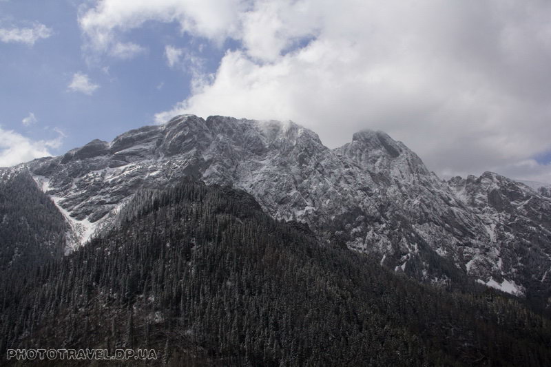
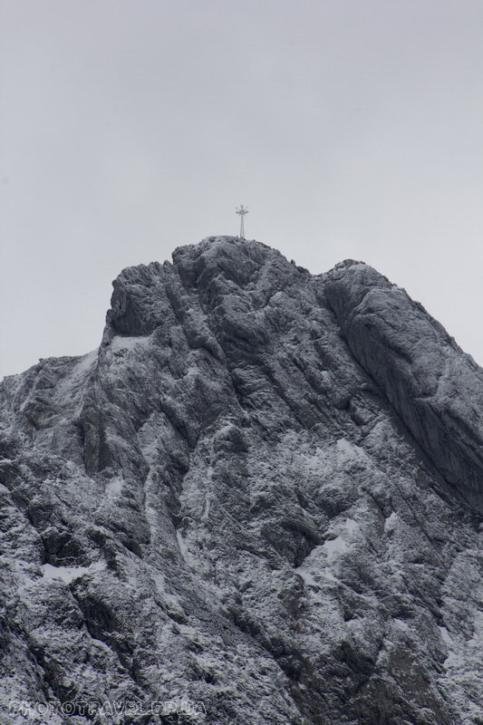
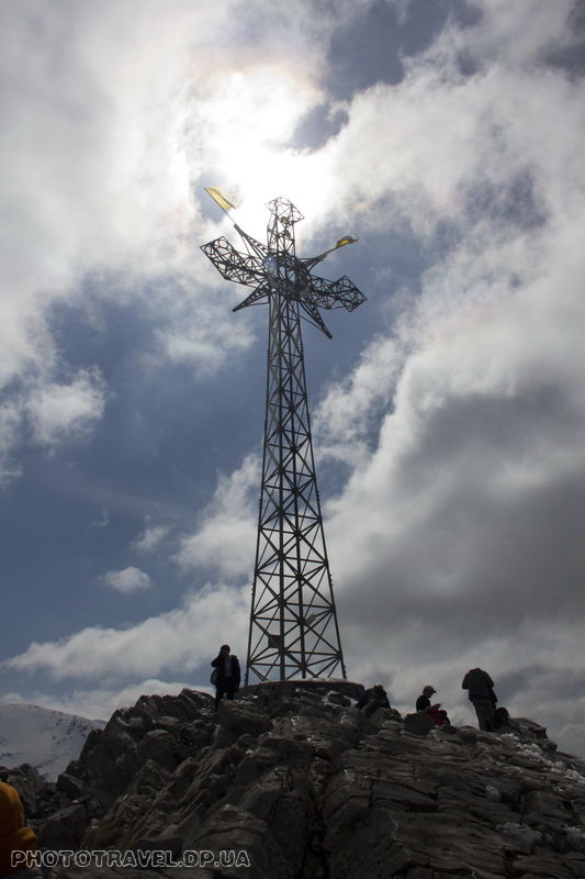
Gewont is a whole array. On the long side, the Gewont consists of three main peaks: the Small Gewont (Maly Giewont - 1728 m), the Large Gewont (Wielki Giewont (1895 m) and the Long Gewont (Dlugi Giewont - 1867 m). Most often, by saying Gewont, they mean a Large Gewont on which a 15-meter cross is installed, which can be seen from anywhere in Zakopane, as well as the top itself.
There is a legend - if you look at the Gewont massif from the Zakopane side, the huge rock wall resembles a sleeping knight in its shape. The top of the Big Gewont is the head of a knight, and the torso is a Long Gewont. When Poland is threatened by enemies, the sleeping knight will wake up and stand up for the country. And yet, if you make a wish at sunset, looking at Gewont, then it will definitely come true.

There are several routes to Gewont, most often they go either from the village of Kuznitsa, the ascent to the top of Gewont takes about 3 hours, or from Zakopane along the Strazhinskaya valley (about 3.5 hours) and note this clean time, of course if you are athletic and sufficiently prepared, the climbing time may be less, but in most cases it will be that or more. It is also worth bearing in mind that in winter some climbing routes to Gewont are closed due to the danger of avalanches. So you will not pass through the shortest route from the Strazhistskaya Valley. You will need to cross the ridge into the neighboring valley and walk along it. On other routes, you may need crampons and an ice axe, or at least trekking poles, because there may be dense firn on steep slopes.
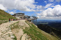
There is another simple option – to take a cable car from the village of Kuznitsa to the Kaspry top and from there along a gentle ridge through Kopa Kondracka to reach the top of Gewont, but it is worth noting that snow may lie on this route until May. And in bad weather, there is a risk of lightning strike on the ridge.
The Gewont ascent is one of the most popular routes in Zakopane and the Polish Tatras, but also the most dangerous, more than 50 people died during the ascent, the main reason being a lightning strike or a breakdown and a fall from a cliff.
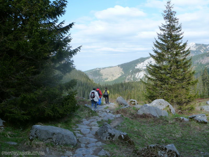
We decided to go a somewhat unusual way and visit another interesting place on the way to Gewont. Namely, start from the valley of the White Stream (Dolina Białego), go through the Chervony pass (Przel. Czerwona), visit the Chamois rock and then climb through the Strazhiska glade to the Gewont.
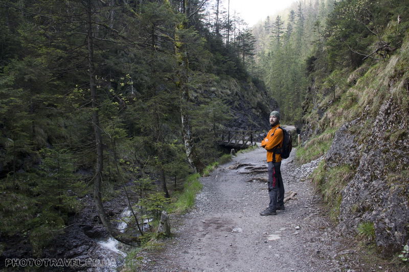
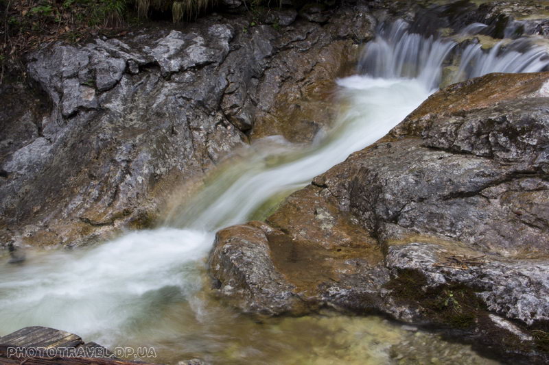
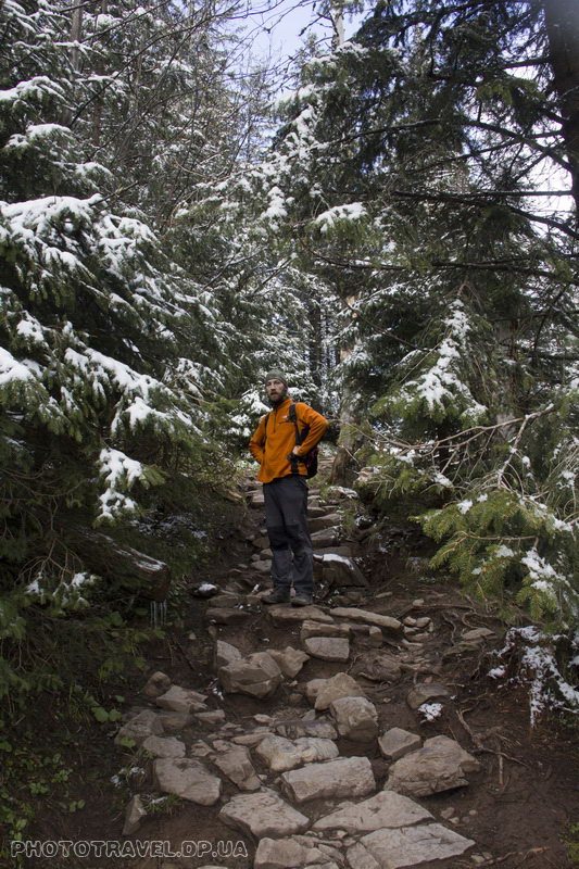
It is only a 15–minute walk from our house to the entrance to the national park and here we are at the entrance - payment of 5 zlotys for entering the Tatra National Park and the river murmuring at our feet. The trail is marked in yellow and there are constantly columns with elevation marks. The ascent is very smooth and pleasant, there are always small cascades and waterfalls on the way.
Bridges will meet in several places, there is a path to the waterfalls – not marked – we missed it, maybe you will manage not to "clap" it. 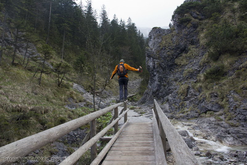
And here we are at an altitude of 1070 m. At this point, the route crosses the last bridge, a small but pretty waterfall is visible. It took about 25-30 minutes to get here from the entrance to the park. And it is from this place that the main ascent to the Chervonyi Pass (1301m.) begins.
 The ascent to the pass took about 30 minutes and here we are at the pass. The yellow marking is over, but the black marking goes in three directions: the path over the Reglami (sciezka nad Reglami) goes in two directions and the radial route to the Serna rock goes in the third direction. That's where we're going now.

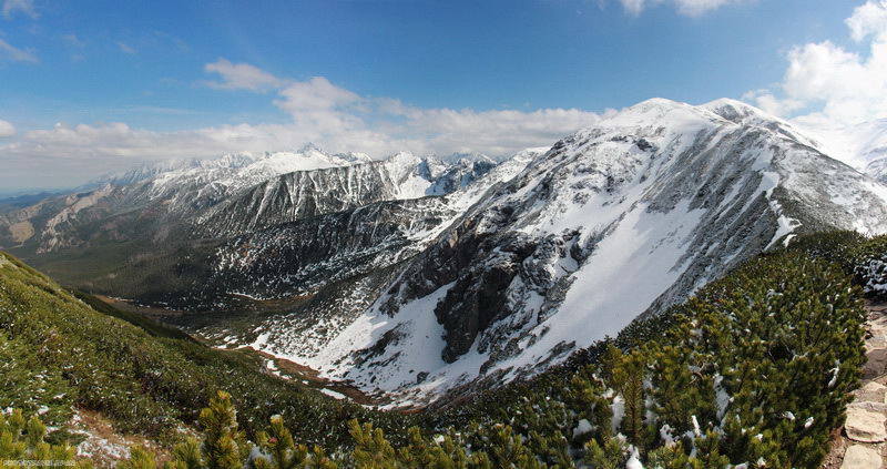
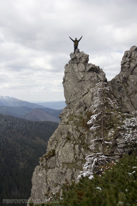
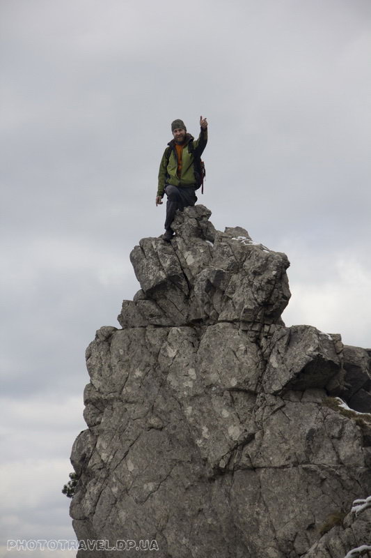
A small ascent and the first observation deck. Another climb and here we are on the Serna rock (1377m.). This small picturesque cliff offers stunning views of the Gewont massif.
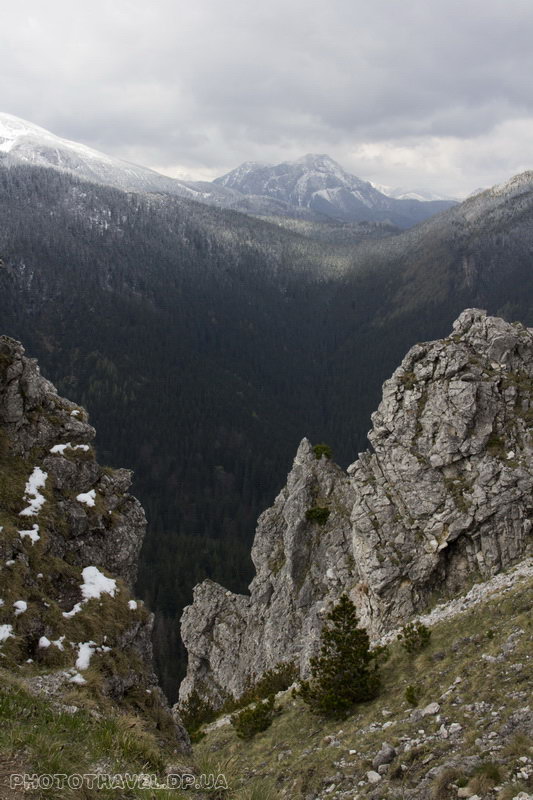
But we looked at the views, captured them in photos, we rested and can move on. We descend back to the pass and further to the Strazhiskaya for another 300 meters of vertical descent. The descent is generally tedious, especially if it is long and runs along a stone path, where you constantly have to balance on the cobblestones. But you quickly get used to balancing and stop paying attention to it.
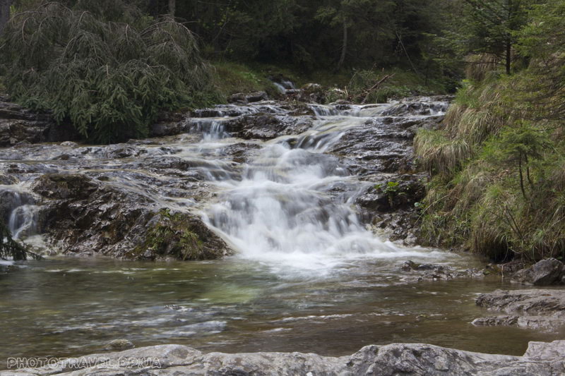
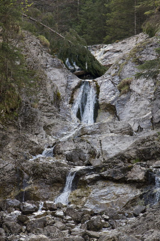
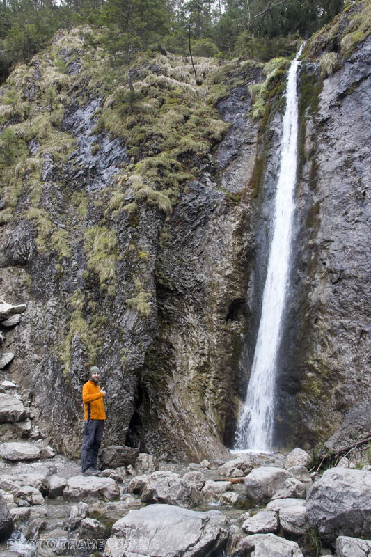
Here is the Strazhiska glade – you can see the hiding place - a mountain shelter, next to it tables with benches and people. And we immediately turn off on the yellow route to the Siklawica waterfall, it takes only 5-10 minutes to walk to it. A waterfall about 20 meters high falls from a sheer cliff, but it is not very deep.
We return to the house, and walk a little more along the dirt road down, 50 meters from the house the ascent path to the Gewont begins.
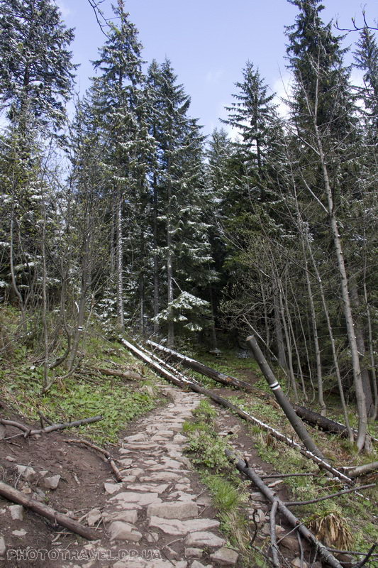
And here is the main ascent to Gewont, first through the forest for about 50 minutes along the black and red markings to the Przel pass. w Grzybowcu. Then through the forest, but not so dense anymore, and at some point the trees become lower, turn into a stand, and now you are already walking on bare rocks. I would like to note that a camera trap was accidentally discovered in the forest, judging by the inscriptions on the back side – to account for tourists on the route – like this!
As soon as the glacier and the rocks appeared, patches of snow immediately began to appear, with each turn they became longer and longer. The trail traverses the slope, with almost no climb. We crossed a small but steep rocky ridge (it's definitely worth taking a picture on it!) and our eyes opened to a view of the saddle near the Little Gewont. A little more and we're on the saddle. A light breeze is blowing, the sun is shining, snow and stones are underfoot. Somewhere below there is a forest, and around there is a kingdom of snow and stones – you look and can't believe that the month of May.
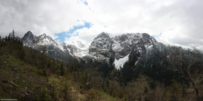
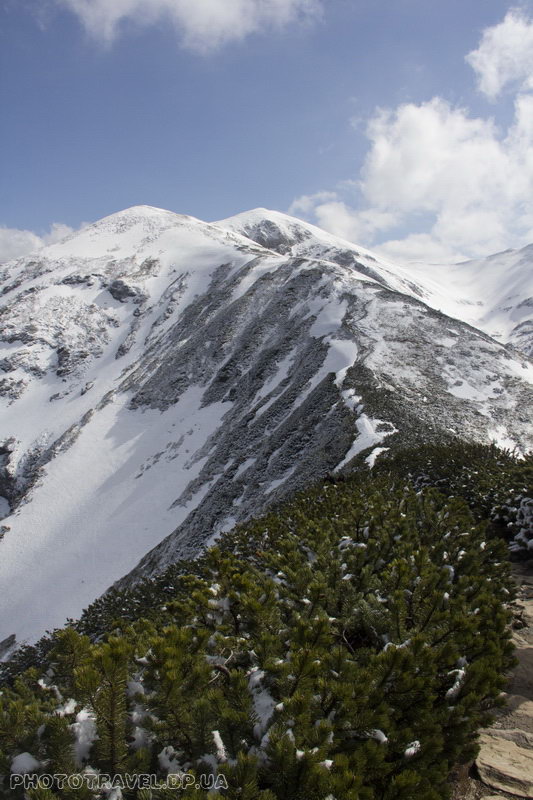
From the saddle there is a smooth ascent to the ridge between Gewont and Kopa Kondratska. People are visible on the Big Gewont, in the lobby below you can see several chamois – it's a pity that it's so far away
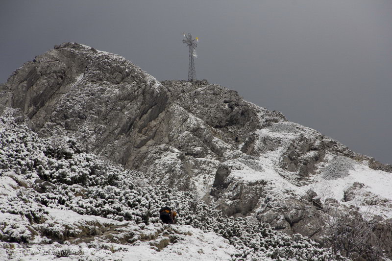
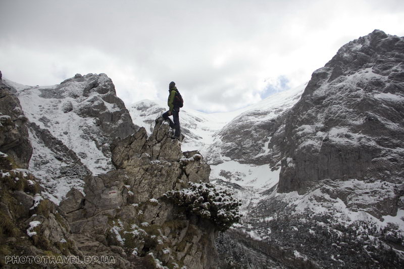
There is a trail with a blue marker along the ridge to the top, the trail starts gently, but it gets steeper and steeper. At some point, it divides one into an ascent and the other into a descent and chains are hung. In principle, they are not really needed, but sometimes it is nice to have such a support at hand. And here is the top! A huge cross stands above us. The whole city is buried in the palm of your hand. Towards Zakopane, everything is green and it feels like summer is near, with snow-capped peaks and ridges behind.
But it's time to go home – we decided to go down the shortest way – to the Forge. But either we were tired, or the road became longer, but we walked for quite a long time.
First down, serpentine to the hiding place of Hala Kondratowa. And then another and another on the way past the Kalatowka glade with the hotel, past the Albertine monastery and the turn to the Albertine monastery. Here we are in the Forge a little more, but it turned out that at 19 o'clock there are no buses and there will be no more. It's good that there are four of us – 20 zlotys and we are driving a minivan taxi to the center of Zakopane. If anything, the bus from the Forge costs 3 zlotys, and it's not much to walk 4 kilometers, but after a whole day up and down somehow I don't want to...
And if you look at Gewont in general, it's worth going – and the peak itself is interesting and the approaches to it, and the view is amazing.
How to get there: To the beginning of the route, namely to the White Water Valley from Zakopane, walk along Droga Do Białego Street, and then a little along the forest road and you will find yourself at the entrance to the Tatra National Park
Coordinates of the entrance to the national park in the Białego valley : 49.277957, 19.957247
Coordinates of the Gewont peak: 49.250833, 19.934191
Other tracks on the Polish Tatras:
Orla Perć (Eagle Path) - the most difficuilt route in High Tatras
So it happens that this weekend we were in the Tatras mountains - in fact it was a meeting for training, before climbing Lenin Peak.
And additionally friends from different countries decide...
Zakopane, trekking in the Koscieliska Valley, Western Tatras, Poland
The Koscielska Valley is located in Poland and is very popular. And there is something for it – it is not difficult to pass, it is very picturesque, with peaks and lakes, a canyon, and four of the ...