The track around Annapurna, or as it is also called the Annapurna Track, is considered one of the most impressive trekking routes in the world.We walked this track on our own, although this was our first trip to Nepal, so you can do it too, and for this we described in detail every day of the route.
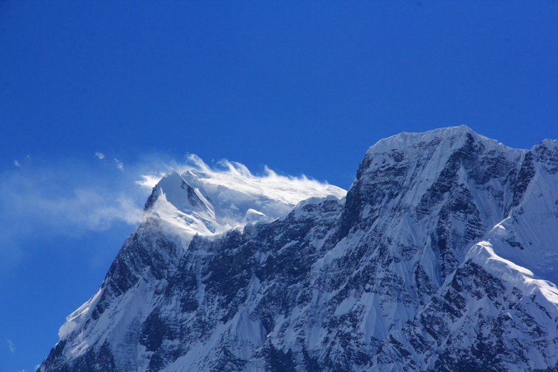
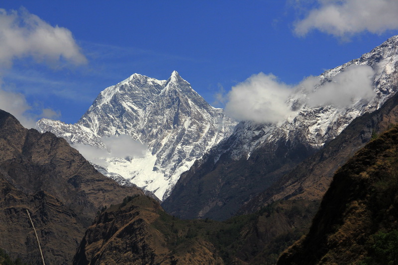
The Annapurna Ring runs around the Mount Annapurna massif. This is the first eight-thousandth mountain that has been climbed. The height of the main peak of Annapurna is 8091 meters, it is the tenth highest mountain in the world. Next to the main peak of the massif, Annapurna I, there are two secondary peaks: Annapurna Central (8051 m) and Annapurna East (8026 m). Also, there are 13 peaks in the Annapurna massif with a height of more than 7000 m and 16 exceeding 6000 m.
- Kathmandu to Bulbul
- Taranche - Jagat
- Jagat - Dharapani
- Dharapani - Chame
- Chame - Upper Pisang
- Upper Pisang - Ngawal
- Braga - Ice Lake - Braga - Manang
- Manang - Yak Kharka
- Yak Kharka - High Camp
- High Camp - Torong La Pass - Muktinath
- Muktinath - Jomsom - Marfa
- Marfa - Tatopani
- Tatopani - Pokhara
We flew to Kathmandu, the capital of Nepal, from the Indian city of Delhi. Nepal is the final country of the Asian part of our "4 Oceans" trip.
We went to Nepal with very specific plans - to complete two tracks:
- track around Annapurna
- trek to Everest Base Camp via Gokyo Lakes
So when we arrived in Kathmandu, we immediately got down to business - we issued permits and prepared for the tracks, you can read about this in the article 'Everything you need to know about tracks in Nepal'.
Most often, the track around Annapurna starts from Besisahar and in the direction of Besisahar-Manang-Torong La-Muktinath- and further, since if you go in this direction, the climb is very smooth and acclimatization is better - getting used to altitude.
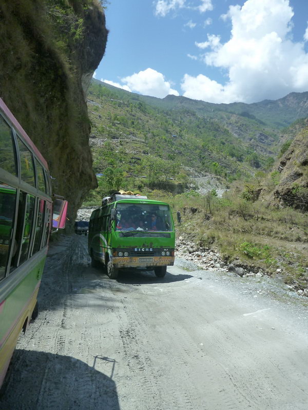
Now there is a passable road from Besisahar to the village of Bul-Bul, even buses go there. And then jeeps go all the way to Manang. But if tourists drive up, they drive no further than the village.
Preparing for trekking in Nepal, everything you need to know
This year we walked the track around Annapurna in Nepal and the track from Jiri to Everest Base Camp through the Gokyo Lakes and we want to share the nuances of these tracks.
Since we do no...
To be honest, you can already walk along the trail from Bulbul, and not breathe the dust of jeeps. And the trail runs along the other side of the river, which means that jeeps will not interfere. And you can also get to Bulbul by regular bus from Kathmandu, which departs early in the morning from the new bus station and costs only 475 rupees ($4.75). And by the way, our bus in Besisahar picked up a couple of tourists to Bulbul for 200 rupees per person ($2), which is less than a tenth of the entire journey. So you should immediately decide where you are going.
The travel time from Kathmandu to Bulbul is about 7-10 hours. It depends on how many locals you pick up on the road ;)
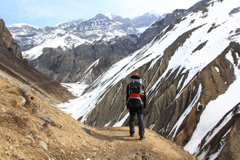
And so we are at the start, or rather ready for it - on March 18, we set off on our first track in Nepal - the track around Annapurna. The track turned out to be quite long, not so much in terms of distance, but because I wanted to write it! So if you were looking for the most detailed trekking report around Annapurna - here it is!
Kathmandu to Bulbul
18.03 Kathmandu - Besisahar - Taranche
At 6:45 a.m. we left Kathmandu for Bulbul, the ticket costs 475 rupees ($4.75). We took the tickets the day before at the new bus station. It can be reached in 20-25 minutes on foot from Thamel or by local minibus, although comfort is not guaranteed...
The road from Kathmandu to Besisahar meanders among the mountains, then steeply climbing the pass, then descending into the valley to the river itself.
We arrived in Besisahar at about 15 o'clock. The bus stopped near the check point, all the tourists got out and made a mark in tims, after that the bus continued on its way. Immediately we picked up several tourists to Bul Bul, they were charged 200 rupees ($ 2), so it's better to go straight from Kathmandu to Bul Bul.
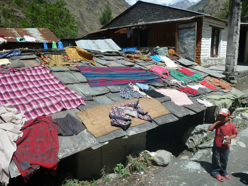
Another hour on the way and we are in Bulbul. Although there are clouds on the horizon, we decided to take a little walk to warm up. The road is very dusty and there are a lot of trucks involved in the construction of the road. But we didn't go far, even in Bulbul we talked to a man and he offered to stay at his guest house. The room is free, payment is only for food.
We were going to walk to Ngadi, and his guest was 1-1.5km earlier, but it started to rain and we decided not to get wet.
The accommodation is a house, with amenities in the yard, an outlet, although there is no electricity. And we will see what impressions of the overnight stay tomorrow. It is worth saying that this was our worst accommodation for the entire track. So it's worth paying more attention to the choice. But in any case, we did not lose much, because according to the story of our friends from the bus in Bulbul, they paid 300 rupees per room ($ 3) and the food prices were also not happy.
Taranche - Jagat
The night was successful, which is a plus, but sometimes we were woken up: there were some animals running around on the roof, rustling in the next room and a mouse squeaking, so I had to get up at night and hide the food, especially considering the size of the rat I saw in the evening.
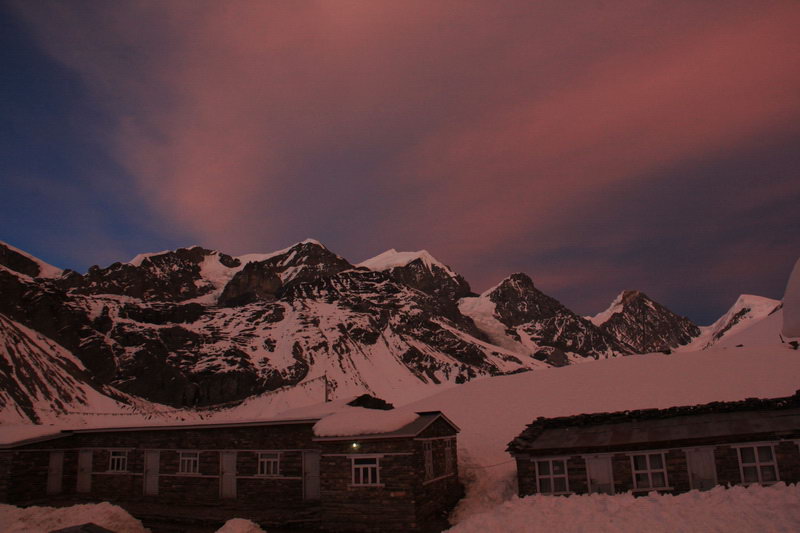
We had breakfast half an hour late, but with a beautiful view of the snow-capped peaks, the presence of which we did not even suspect in the evening.
We paid 2,240 rupees ($22.4) for the food, because there was nothing to spend on the master's - we are family, friends and tea treats with the words that it is free. However, then a whole thermos of tea appeared, which we did not ask for, we thought it was free, but no. In the morning, they brought us a large thermos of tea again, which no one asked for, but we drank it trustfully. But after voicing the amount and what for what - we went and poured the remaining liter of tea into a bottle for the road.
We left around 8 a.m. After yesterday's rain, yesterday's dusty road turned into a muddy mess. It's quite slippery, but there's no dust.
Soon we passed the construction of the dam, after that the dirt on the road disappeared and the trucks too.
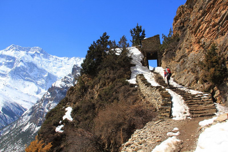
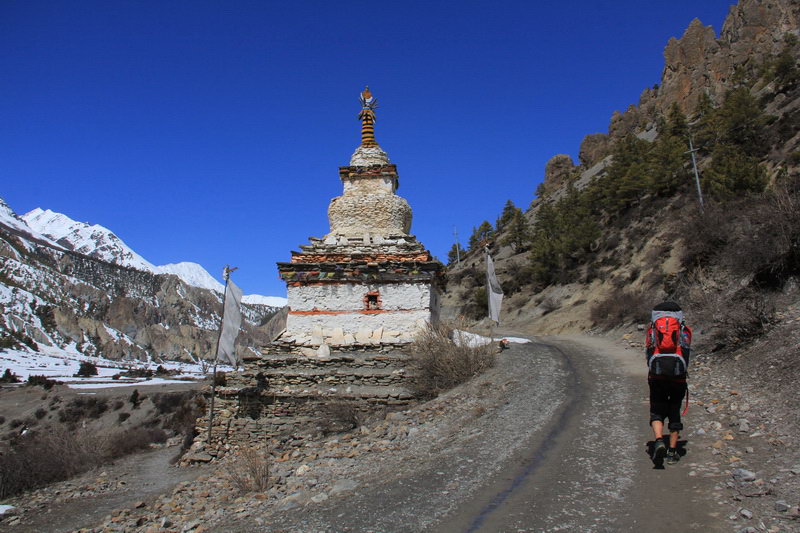
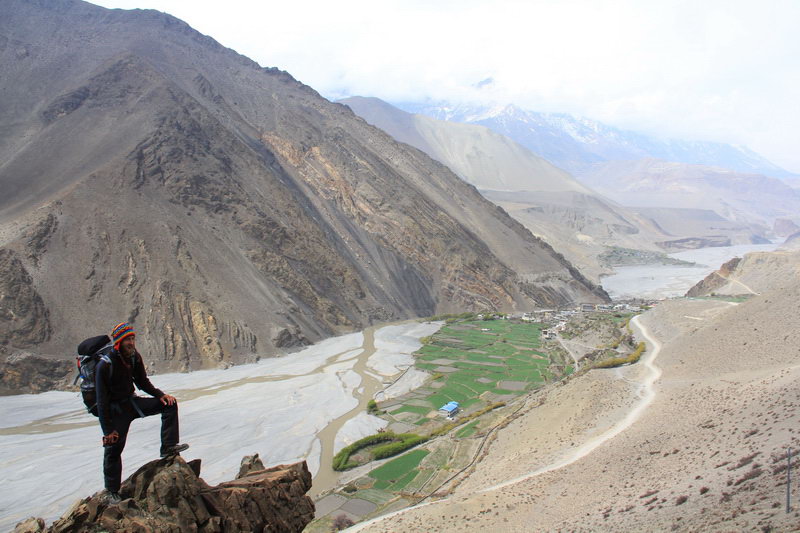
In front of the hill with the village at the top, a good path branches off from the road, this is the track. At the top is the village of Bahundanda, there is a checkpoint where they check the permits to enter the Annapurna Conservation Area (ACA).
Literally 70-100 meters from the checkpoint, the trail goes down sharply, and on the left there is a bamboo gate and a path to an excellent observation deck. It is worth making a halt on it, which we actually did.
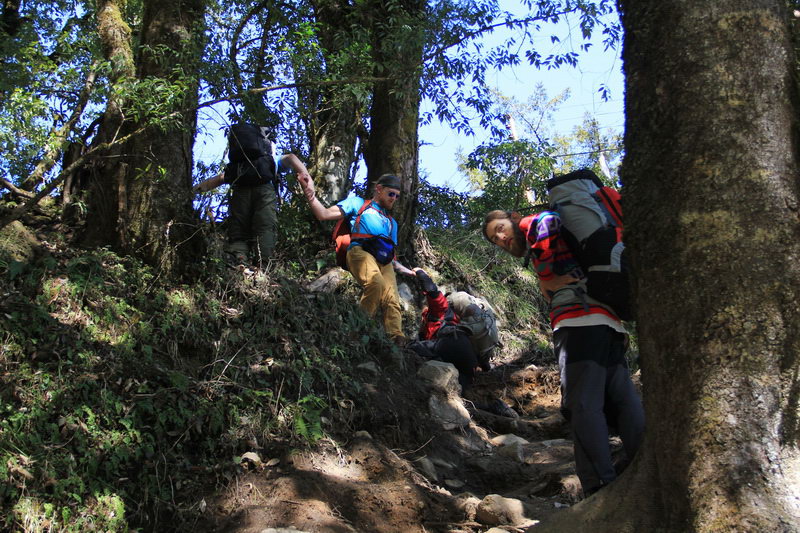
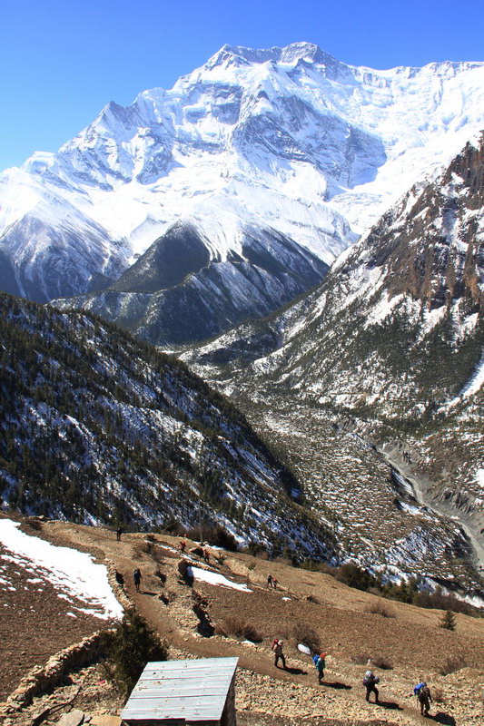
On the way down, we met the first returning tourist. And he returns due to the fact that the Torong La pass is closed due to the snowy situation. It is unknown when the pass will be opened, but let's hope that by the time we get there it will be opened.
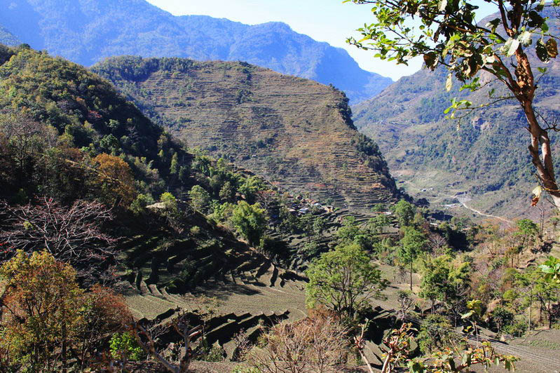
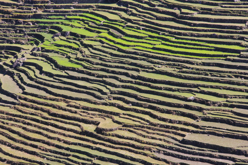
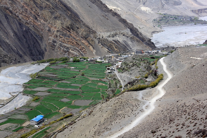
Then the traverse trail runs along the slope among picturesque terraces planted with rice and vegetables.
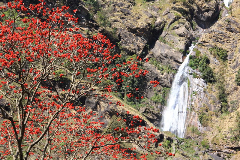
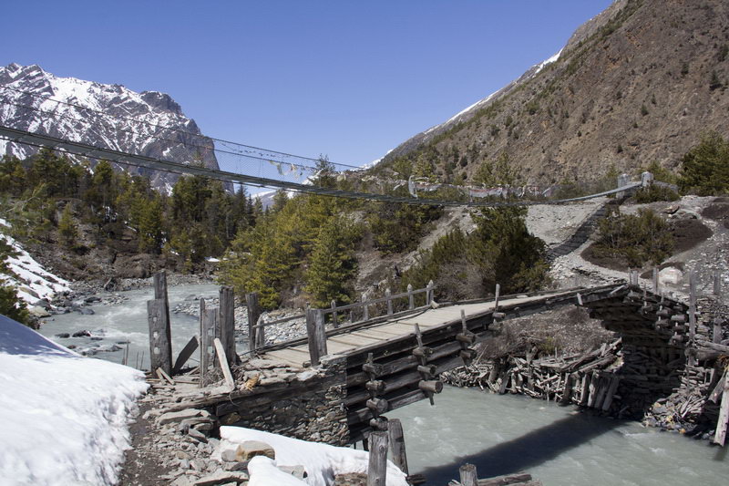
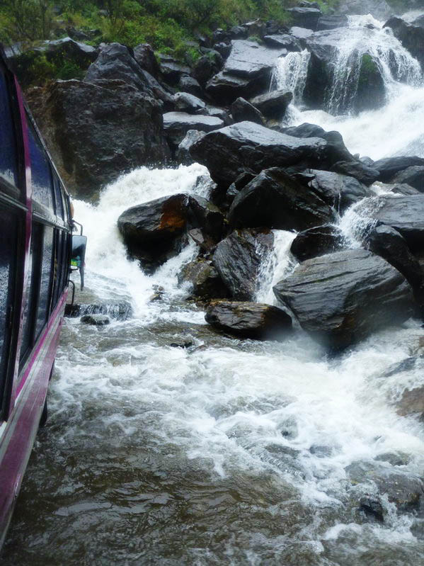
But on the other side there was a large waterfall and almost immediately we met a village with a bunch of cafes and hotels, and behind it the path sharply serpentines down to the river and the bridge on the other side of the river.
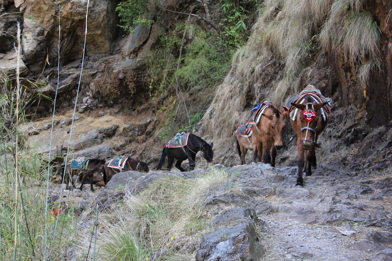
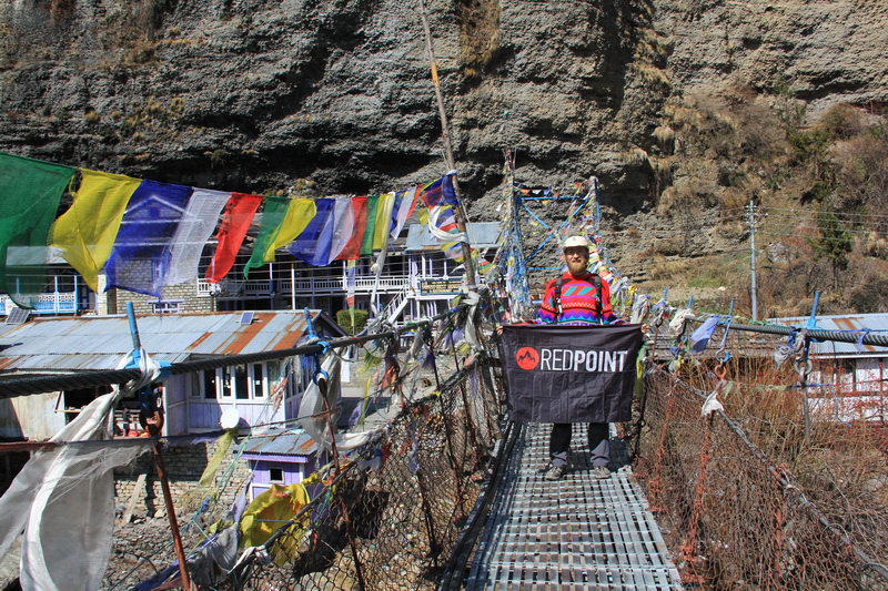
Behind the suspension bridge is the village of Syange. Near the exit from the bridge, a column of mules loaded with bags of something tried to trample us.
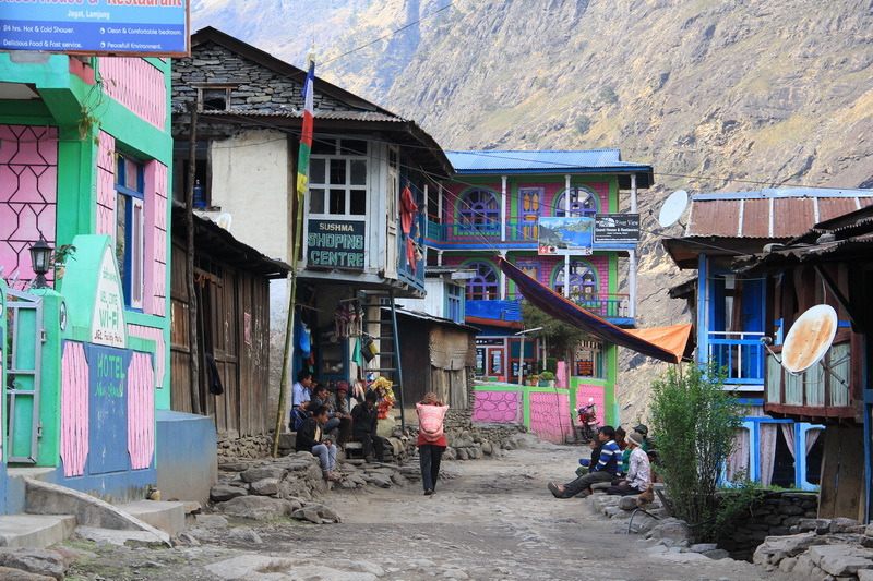
According to the plan, we are staying in Jagat today. You have to walk along the road to get to it, but there are almost no jeeps and the road is not very dusty. At first, the road goes almost in a straight line, soon a hydroelectric power plant appeared on the other side of the river. Directly opposite the station, the road serpentines uphill. The ascent takes 20-30 minutes. After some time, the road descends to the village of Jagat. That's where we decide to stop. At the very first Mont Blank hotel, when asked about the price of rooms, we were asked where we were coming from and how much we paid there. In general, after our explanation that we only paid for food, and the accommodation was free, we settled in this hotel on the same terms. Only the room is cozy with a beautiful view from the window, in a good house, hot shower and free wi-fi. However, there was also a request not to tell other guests that we live for free.
In total, the Taranche road (2 km from Bulbul) to Jagat took 5 hours with all halts, stops in the photo, etc.
Jagat - Dharapani
The morning began as always with waiting for breakfast, well, they don't know how to cook for the time you ask for. The meal cost 2,070 rupees ($20.7).
Behind the Jagat, we looked very carefully for a marker so as not to miss the turn to the path that goes around the road. Literally immediately after the Jagat, we saw a path going up and next to it a stone with a red arrow pointing to the path. Deciding that this was the marker, we went up. The path is goat, overgrown with nettles, so we went down at the first opportunity.
And so we go happy on the road, and here is a map and a large-scale pointer to the path we need. That's it. This trail begins 1.5-2 kilometers beyond the Jagat (more precisely, behind the main cluster of houses, since houses along the road are found regularly).
The path is picturesque, goes uphill, and then descends again to the road, but already in Chamcha. There is a great view of the waterfall along the way, and the local fauna is easier to see.
Before entering the village, the path splits: the one to the right goes through someone's yard and somewhere further, and the one to the left gains a little height and, as it were, bypasses the buildings. Naturally, we decided to follow the left path and made a mistake. The right path goes inside Chamche.
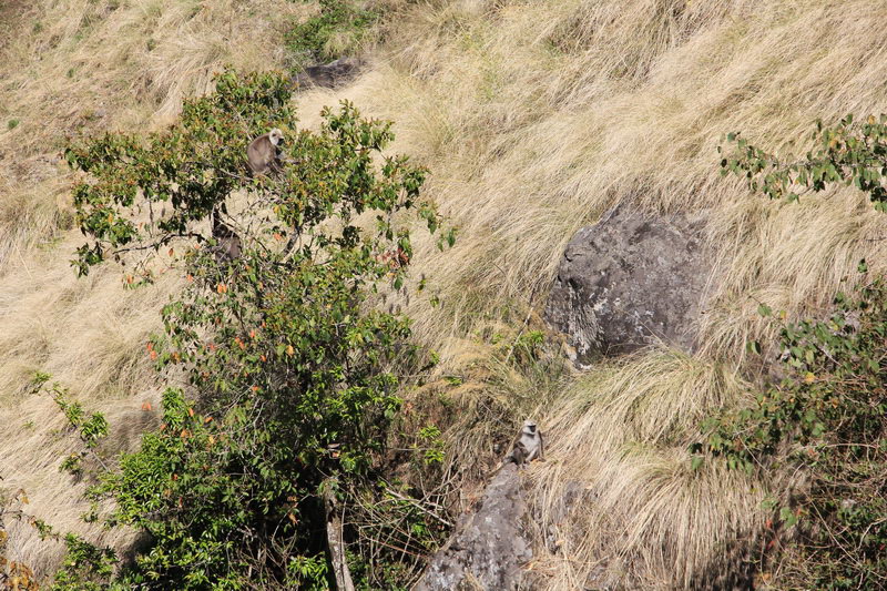
There are hotels, shops, and cafes in the village. Somewhere in the middle of the village there is not a very large sign for the trail of the track. The path goes down to the bridge and crosses to the other side of the river. That's where the ascent begins. First, a nice serpentine up to the little house. Then a little smoothly up bypassing the ravine. By the way, it was here that we saw a flock of langur monkeys.
There is still a rise beyond the ravine, judging by the people resting in the middle of the rise in the cafe, it is not easy for them. At the top of the hill there is a table with the travel time between the villages and the altitude. Very convenient.
And then there was the descent to the Tal. It looks like Tal is the last village on the track, where it is massively offered in a set with a wi-fi room.
After the Tal, the trail goes without special sets and height losses and as a result, judging by the signs, goes to the other side of the river, although according to the map it should not.
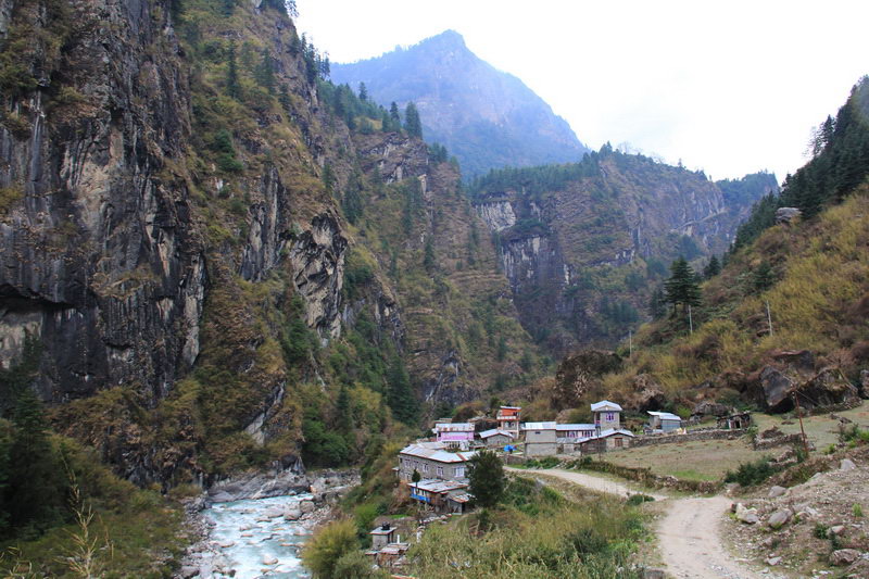
On the other side there is a road along which jeeps very rarely pass. In front of the village of Karte, you need to cross the river, although you can continue along the road. The trail, unlike the road, constantly jumps up and down, and the whole side view is a rock wall in which the road is cut down. So it's debatable whether a road or a trail is better. The path goes to the bridge near Dharapani. The village is large by local standards. There are probably 10-15 hotels.
We stayed at the Manaslu hotel & guesthouse, this is the third or fourth hotel from the beginning of the village. We live as usual for free, as lunch showed, the portions are quite large, and most importantly there is a hot shower and really 24 hours a day, because there is a gas column.
In total, the Jagat - Dharapani road took 6 hours and 40 minutes. At this time, our small trips enter a couple of times.
Dharapani - Chame
Today is the first day when breakfast was only 5 minutes late. Having breakfast and paying (1890 rupees ($18.9) is lunch, dinner and breakfast) We set off.
At the exit from Dharapani there is a check post where the permits will be checked and the official part will be torn off, and a stamp will be put on your part.
From Dharapani to Dankye there is a smooth ascent road, and it took us an hour and a half to get to this section.
Beyond Dunkye, the ascent to Timang begins. You can beat him on the road, or you can follow the trails. The trails are steeper, but the distance is much shorter. According to our map, Dankye is 2190m, and Timang is 2750m, well, we expected to set 560 meters, but it turned out to be much less about 300 meters and spent only 1 hour and 10 minutes. But some people find it very difficult to climb, so they crawl on their knees, and they are pulled by their hands...
After Timang, the road should smoothly drop the altitude to 2400m in Thanchowk. But this village turned out to be higher than Timang. After that, we stopped trusting the map. Only later will we realize that this is the norm on Nepali maps - a bunch of typos.
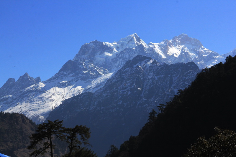
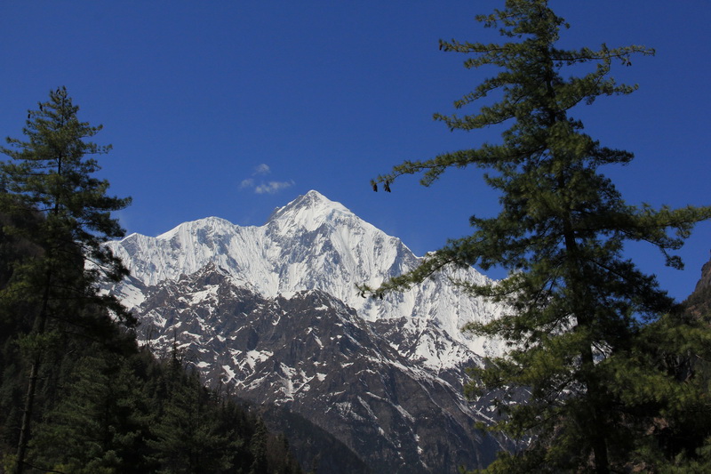
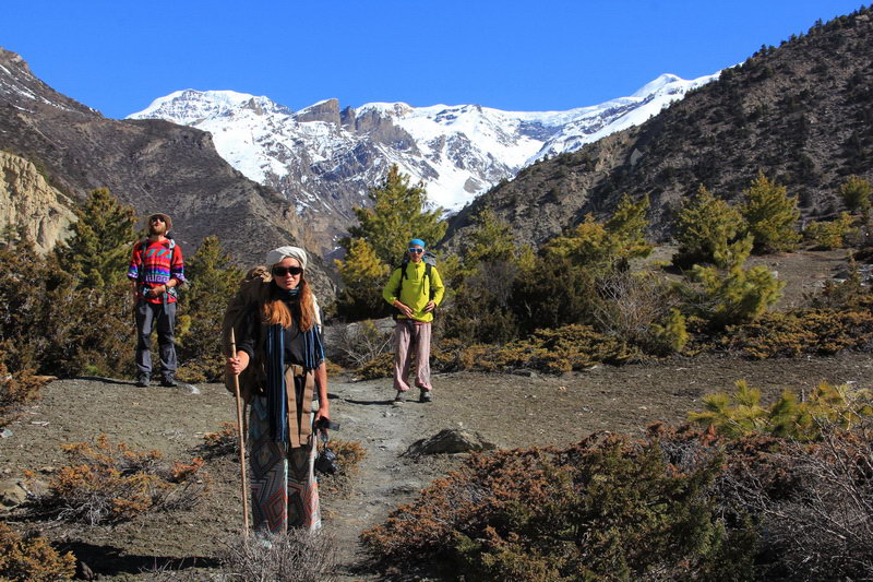
More and more beautiful views are opening up around. We are already surrounded by snow peaks on all sides. Timang offers a great view of the Manaslu massif.
It is worth noting that Timang is divided into two parts and there is also a rise between them. From the second Timang, the road goes smoothly up to the bend on the ridge, and almost immediately houses appeared behind the ridge. The journey from Timang to these houses took 30 minutes.
Then the road smoothly drops the altitude to the village of Koto, where the checkpoint is located.
It's not far from Coto da Chame, even the houses are already visible. And here we go, let's go, let's go, it's written in the Cham. Another woman upstairs was agitating us to her hotel, the second one spoke after entering. So we went to the second one. We agreed to spend the night as usual for free, had lunch, took a shower and decided to take a walk. But it turned out that there are 1-2 more houses behind our hotel and that's it, and the main Cham starts in 200-300 meters. So tomorrow we will have 300 meters more. But the hotel is good, the room is great, hot shower, Internet and delicious food. Speaking of the price of food, strangely enough, but so far it is getting cheaper. The most expensive was in Jagat, cheaper in Dharapani and now even cheaper in Chama.
In total, the journey of Dharapani Chama took 5 hours and 15 minutes, with all stops.
Chame - Upper Pisang
The morning, as usual, was greeted with excellent weather. We paid for the overnight stay, so far the cheapest 1,680 rupees and moved through Chame. At the end of the Cham, the road crosses to the other side of the river. Beyond the bridge, there is a fork to the right to the hot springs, and to the left to Manang.
The road goes along the river gradually gaining altitude. Almost immediately after the bridge, we met the guys from St. Petersburg and then we were walking together. So, while talking, we ended up in Bratanga 2 hours later, without even noticing how time flew by.
After about 1.5 km beyond Bratang, the road crosses to the other side of the river. There are two bridges, pedestrian and automobile. A marked trail starts from the pedestrian bridge. The trail rises quite steeply, crossing some road several times. In several places there were houses with tea and drinks, and the trail was covered with either mud or snow. As a result, the trail entered the road and led to the village of Dhikur Pokhari.
At the end of the village there is a sign for Upper Pisang. If you follow it, you will soon find yourself on the shore of a small lake, and a little further on the path over the bridge will cross the river. Beyond the bridge, the path is gradually gaining altitude. The valley is wide and at one point we even met a football field.
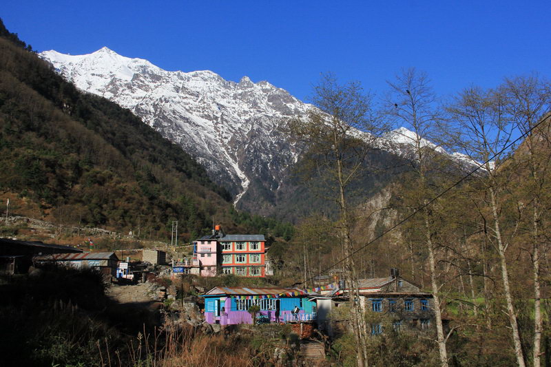
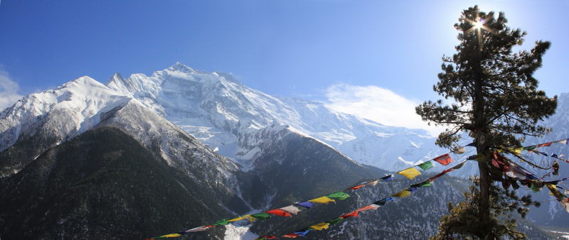
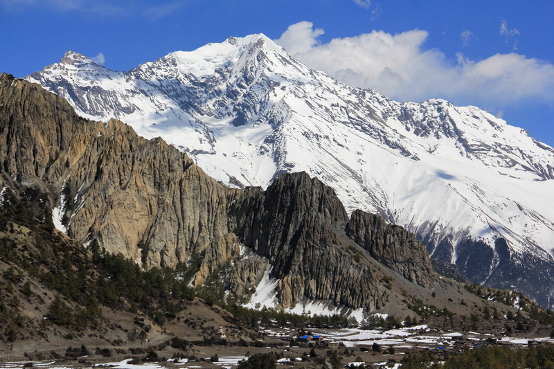
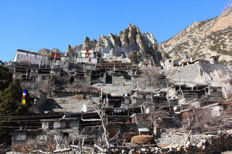
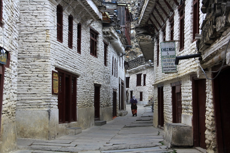
A little more and because of another small rise, Upper Pisang appeared. The village consists of many stone houses on a rather steep slope with small alleys between them. Hotels are scattered throughout the village. Many of them have excellent views of the top of Annapurna 2 and the surrounding ridges.
We stayed at the Tukuche Hotel, as always for free, only payment for food. Wi-fi has been announced throughout the village, but something has broken and it is nowhere to be found. And also in this hotel there is a shower from the sun and from the gas, but something did not work out with the gas, and the sun was not very warm. But the room is nice, the view is great, and the staff even knows a few words in Russian.
In total, the Upper Pisang Cham path took 5 hours with all halts.
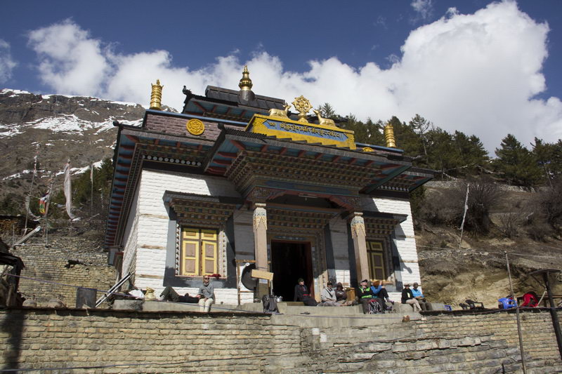
In upper Pisang, it is worth going to the gompa, since the middle of the day there are many tourists, and the monastery itself is beautiful
If you go behind the monastery and climb the hill, you will have a great view of Annapurna 2, and Nepali prayer flags are developing on the hill.
Upper Pisang - Ngawal
In the morning it was 10 degrees in the room and this is the first night where the temperature outside dropped below 0 at night.
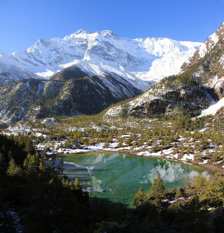
We left the Upper Pisang at 7:30, the weather, as usual, is cloudless. The trail starts on the far side of the prayer mills. Basically, the trail traverses, sometimes gaining a little height. At the very beginning of the journey, the lake will be visible below, the path from the Lower Pisang goes along the shore. Well, to enjoy the view of the turquoise water, we went to the spur above the lake, literally 50-60 meters from the main trail. The lake is very picturesquely framed by pine trees, and the peak of Annapurna 2 is reflected in its waters.
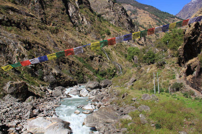
The trail goes through a pine forest and it is very pleasant to walk along it. Soon we came to a religious masonry building. It is from here that the main ascent to Ghyaru begins. The trail crosses the bridge over the gorge and climbs the mountain in a steep serpentine.
Somewhere in the middle of the climb there is even something like a kiosk with tea, water, and chocolate bars.
At the very end of the climb, we ran into the wall surrounding the stupa, there is a door in it and you can climb the steps to the observation deck, there are benches overlooking the Annapurna massif, but there is also a slightly intrusive service of tea, coffee, etc. nonsense. Although as soon as new people appear, all attention turns to them.
The trail winds between the houses in the village and goes out onto a slope with fields. Literally after 500 meters, the trail crosses a stream. Along the trail, you constantly come across masonry, with unknown inscriptions, gates.
The trail gradually gains altitude, moving from spur to spur. At the highest point there is a table, benches and a stone bar where you can buy tea, drinks, rolls and much more.
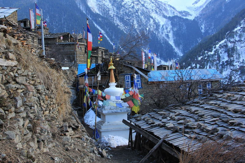
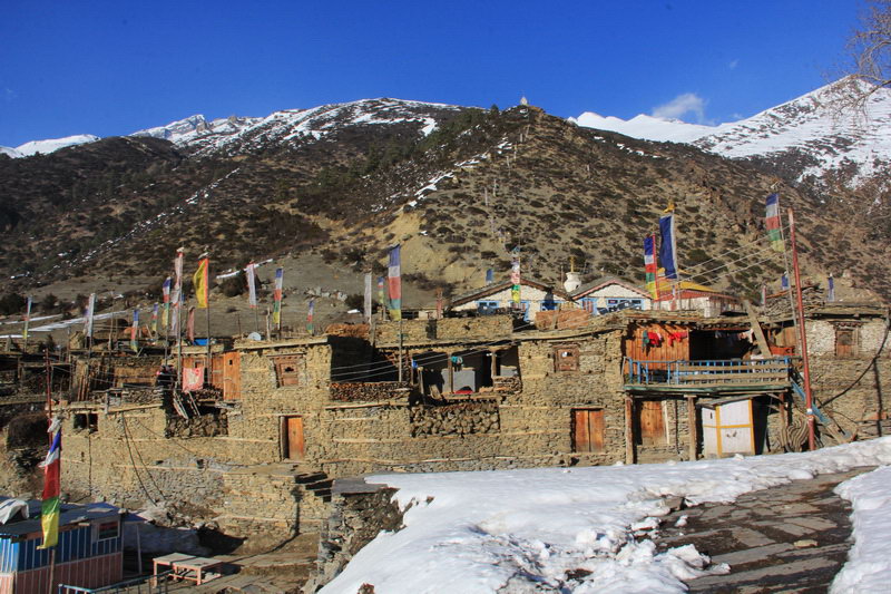
After this point, the trail gradually descends and soon the village of Ngawal becomes visible. The village is very similar in style to upper Pisang, all the same stone houses, hotels look very bright against their background.
On this day we decided to stay in Ngawal, because its height is 3660 meters, which is higher than in Manang. We stayed at the Tibet guest house hotel, which is located behind the second line of prayer mills, behind the turnout. Accommodation is free as usual, the room is decorated with wood and even has its own toilet, of the disadvantages there is no outlet in the room, but you can use a public and hot shower from the sun, i.e. not very hot for free, but gas is already 100 rupees ($ 1). But they say they can give you a bucket of hot water.
In total, the Upper Pisang - Naval route took 4.5 hours with long stops to admire the scenery.
Today we had a relaxing day. We only went from Naval to Braga, and this is a small descent and a little walk through the valley.
There are two trails from Ngawal: one immediately descends into Humda and you will have to follow the road further, and the second bypasses the hill, descends and leads immediately to the village of Munchi.
We decided to take the upper path, it starts at the upper stupa. First he walks along the fields, then climbs the hill, a white stupa can serve as a landmark. Then the path approaches the monastery building, but near the monastery stupa, we almost lost it. But then they found a marker. It's probably hard to lose it in April or autumn, but there was snow in our forest and the trail was rarely visible.
We went down through a beautiful pine forest to a stream, there is a bridge across it, and markers are generally found behind the bridge. The path descends smoothly down, then climbs a small hillock, and beyond it comes out into a clearing with a couple of houses. After the cabins, the trail turns almost into a road and comes to the village of Munchi.
In this village, it connects to the main road and goes all the way to Manang. But we decided to stop in Braga to go to the Milarepa cave and to the Ice Lake.
The hotel was chosen as one of the first new yak. You can also stay at their place for free, but only in rooms without a toilet. A room with a toilet costs 200 rupees ($2) if you eat at their place and 400 rupees ($4) if somewhere else, but there are few other places in Braga.
Back in Ngawal, we were told that Milarepa's cave is most likely inaccessible (the cave is located on the northern slope, and there is still a lot of snow and the path is not trodden). After coming to Braga, this information was confirmed. But we still decided to try to go towards the cave.
There is a bridge in front of the village of Braga, so the path to the cave of Milarepa should begin behind it. But now there is only a snowfield behind the bridge and a lonely trail going in the right direction. We followed the tracks, sinking knee-deep and higher in places. And we came to the lower part of the couloir, along which the path should go. At the entrance to the couloir there is an old avalanche drift several meters thick, already sprinkled with fresh snow. And above on the couloir, a fresh avalanche outflow is visible, but smaller than the first one.
The couloir is quite steep and narrow, there is quite a lot of snow at the top, so we decided not to take any chances and did not go any further.
As a result, the Bulk Braga road took about 3.5 hours, but if there is no snow, then the journey will take less time.
Braga - Ice Lake - Braga - Manang
Today we decided to arrange an acclimatization day and went to Ice lake.
In order not to walk on muddy ground, we wanted to leave at 7:00, but as usual it did not work out and we left at 7:15. Since the lake is located on the southern slope, it is open to the public, unlike the Gokio lakes.
The trail to the lake begins in the center of the village of Braga. There is a signpost from the main road. The trail passes by prayer wheels, and then turns into the ancient courtyards of Braga. There are blue and white markers or pointers everywhere.
Beyond the village, the trail goes out onto the slope and leads towards Munzhi for quite a long time. At the end of the traverse there is a pointer to the top and the trail from Munzhi comes.
Then the trail abruptly gains altitude, winding down the slope. At the end of this climb there will be a clearing, and a stupa next to it on a hillock. There is a sign on the path in the clearing.
It started snowing from this clearing. At first it was shallow in places, but very soon it became permanent, and in places it was very deep. After the clearing, the next ascent begins, there are two options by traverse or along the ridge. We walked along the ridge so as not to walk in the snow. There is another observation deck with a stupa at the top, the height here is 4100m.
From here, the slope becomes not so steep, but solid snow begins. Sometimes you fall into the snow up to your knees, or even up to your backpack. For a while the trail goes along a hollow, and comes to another steep slope. This is the final ascent and from the top of the hill there is a view of the valley in which the lake is located. But when we went up there, we saw only snow and ice, well, in one place there was something like a shore.

The climb took 4 hours and 20 minutes, but if there had been no snow, it could have been faster.
The descent along the same route took 2 hours and 20 minutes, but if there had been no snow, it could have been longer. And we also met guys from Germany who went down very quickly
There is also an alternative option to climb from the village of Munji. And after going downstairs, we decided to change our place of residence and went to Manang.
Manang differs from other villages primarily in that different hotels have different menus and different prices of dishes, and sometimes the cost differs twice, so before you look at the room, look at the menu.
In Manang, we stayed at the Margyandi Hotel. This is a small hotel in the center of Manang, the rooms are small and gloomy, but clean and tidy. But the menu is very diverse and cheaper than in other places. On average, a full-fledged dish is 50-70 rupees cheaper.
In Manang, there is a check post with a small information board, a bunch of shops, including clothes, and even gas cylinders, a cinema where tourist films are shown and a museum. This year, the school of acclimatization and medicine in the mountains will even be opened from April 1st to 30th, lectures on acclimatization are held every day at 15:00, where practical advice is given.
The Braga - Manang route takes about 30-40 minutes.
Manang - Yak Kharka
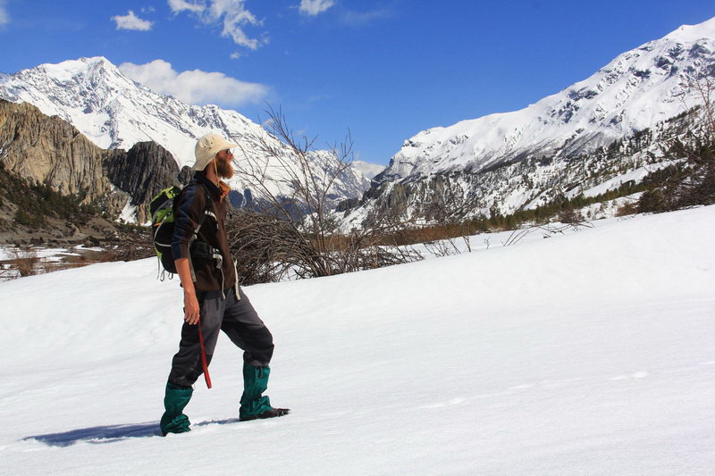
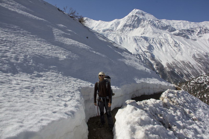
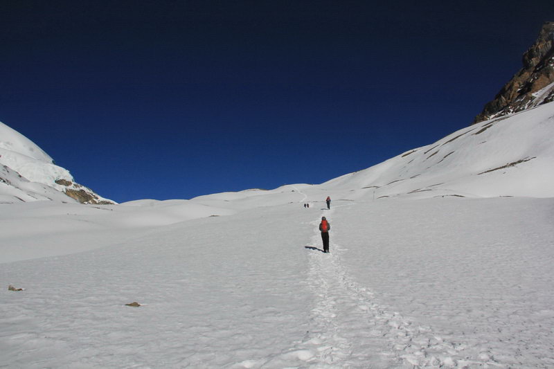
Today, according to the plan, we are going from Manang to Yak Harki, as Lake Tilicho is closed due to a large amount of snow. The trail winds through the village, and almost immediately after the village branches off onto the trail to Lake Tilicho and the Torong La Pass. Beyond the fork, the trail begins to climb up in a serpentine pattern. It is on this section of the road that we have gained the main height of about 400 meters today. The climb was easy for us, it can be seen that yesterday's exit to Ice Lake (4600m) helped. At the end of the long climb is the village of Gunsang. Many trekkers stop there to relax and drink tea. The whole village is 2 hotels. The climb took 1 hour and 45 minutes, but the trail was very muddy and in places with snow.
Further from Gunsang, the trail traverses the slope, sometimes gaining a little, sometimes dropping a little height. After about a third of the way, you will meet a suspension bridge over a side gorge. Previously, there was a wooden bridge, to which it was necessary to greatly reduce the height, and now they have made a new suspension bridge, which is almost at the same level with the trail.
It's spring in the mountains now, so the whole trail is either a muddy mess or snow.
Soon we saw the first hotels with information that this is already Yak Harka, but from them you can see at least three more places with houses. The first is Yak Harka, where about 5 hotels are located, the second is a lonely house, probably also a hotel, but we did not go there, in the third there are also several new houses.
The journey from Gunsang to Yak Harki took about 2 hours.
In Yak Hark, as in Manang, the menu differs in both the set of dishes and prices, with prices sometimes differing by almost 100 rupees. The rooms in the guest houses that we watched are almost identical and cost from 0 to 200 rupees, as agreed. That's why we looked at the menu first.
We stayed at the Nyeshyang Hotel, which is located at the end of Yak Harki and its name is written only on the menu. The rooms are like everywhere else - two beds with blankets and a 3*3 room.
There are no sockets in the room, charging is paid, but we have a Goal Zero Nomad7 solar panel with a Guide10 battery, so we don't really need sockets. This hotel has large and delicious portions and they cook quickly.
In total, the journey from Manang to Yak Harki takes about 4 hours and the climb is about 500 meters.
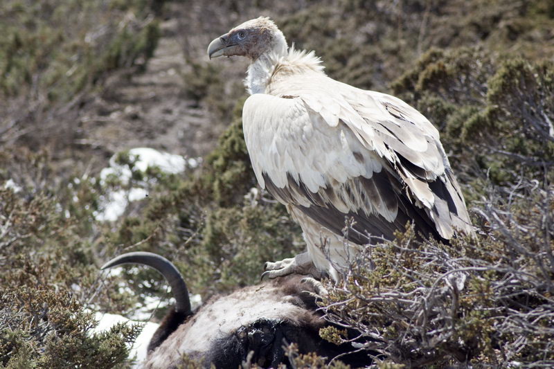
Since we did not come to Yak Kharka too late, we decided to take a little walk. And on a walk we met local birds - Himalayan (snow) vultures. These birds have a wingspan of up to 3 meters, so there is something to see and take pictures of
Yak Kharka - High Camp
We left Yak Harka at 7:20, the trail goes quite hollow to Ledar, without sharp climbs, but at the same time it is covered with snow in places, but we walked in the morning snow and mud were frozen. The trail crosses a suspension bridge, and beyond it lies the Ledar. More precisely, there are 2-3 gests on the slopes that look quite fast. The journey to Ledar took 50 minutes.
From the Ledar, the trail also gently gains height traversing the slopes. About an hour later, a suspension bridge appeared, but the path to it was not trodden through the snow. There was a path on the other side of the river from the suspension bridge. Literally 400-500 meters from the suspension bridge there is a wooden bridge, and a path led to it. From the bridge, the path rises steeply to the tea house, where it unites with the path from the suspension bridge.
The journey from Ledar to the tea house took 1:05 hours. From the tea house, the path still rises gently, but half the way to Thorung Phedi is a talus slope. There's even a sign about it. This section should be passed as quickly and carefully as possible. Since with the appearance of the sun, and here it appears early, stones begin to fall from the slope. When we were walking, there was a small rockfall about 15 meters in front of us, pebbles fell the size of half a head...
The journey from the tea house to Thorung Phedi took 40 minutes. There are two guest houses in Thorung Phedi, a dining room and you can just relax.
The trail begins immediately after the entrance gate and steeply serpentines up the gorge. It is necessary to gain about 400 meters to the High Camp. After the first 300 meters of the set, the trail becomes more gentle. And then the trail goes out to the clearing, where the High Camp is located.
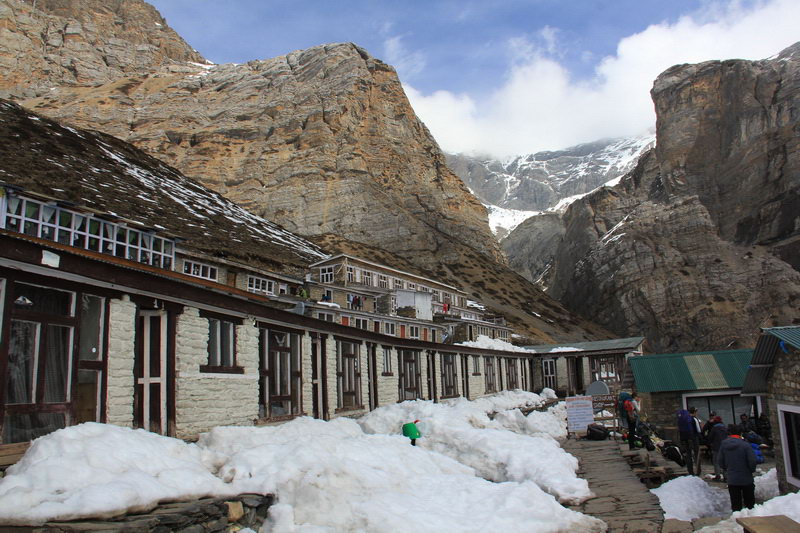
High Camp is one exclusive hotel. It has double and triple rooms, as well as dormitories. A double room costs 350 rupees, a triple room costs 400, a dorm bed costs 100 rupees. The dorm has two-storey bunks, but they are quite spacious. The main advantage of the dorm, except for the price, is that they don't really want to settle people there, at least at 14 o'clock there was no one but us. And by evening, no one had appeared.
The weather was not pleasant, everything was covered with clouds and there was no desire to even go for a walk somewhere. It took 1 hour and 15 minutes to get from Thorung Phedi to High Camp.
But after lunch, the weather cleared up, the blue sky appeared and we ran to the nearest hill, which offers a great view.
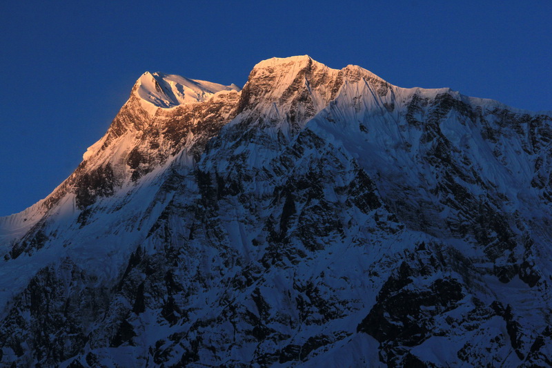
And in the evening we had the most spectacular sunset of the entire track.
In total, the journey from Yah Harka to High Camp with all stops, breaths and photos took 4.5 hours.
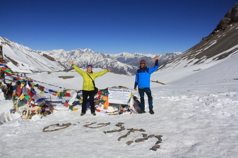
High Camp - Torong La Pass - Muktinath
Today we had the earliest rise and probably the warmest, because there was no one else in the dorm and we had 8 blankets at our disposal, although our wet sneakers were covered with a crust of ice overnight.
We ordered breakfast at 5 a.m. and at 5:10 a.m. it was on the table, but in general we were told that they had breakfast orders from 3 a.m. So everything is fine at the High Camp with early breakfasts.
The High camp came to life long before dawn and going out for breakfast at 5 a.m. we saw lanterns rising up on the slope, and the tables in the dining room were littered with packages of pain pills and chocolates. Unlike many people, we ate a full meal, packed our things and went out on the trail at 5:50.
At the time of launch, it was already light enough and there was no need to use a flashlight. The weather was cloudless, there was a slight breeze (by mountain standards), it was not very cold in the down jacket, but the snow froze well overnight and it was easy to walk.
The ascent goes in steps, then steeply, then gently, which allows you to relax on flat areas. Somewhere in the middle of the rise there is a tea house. There is also a tea house on the pass, but we did not even find out the prices.
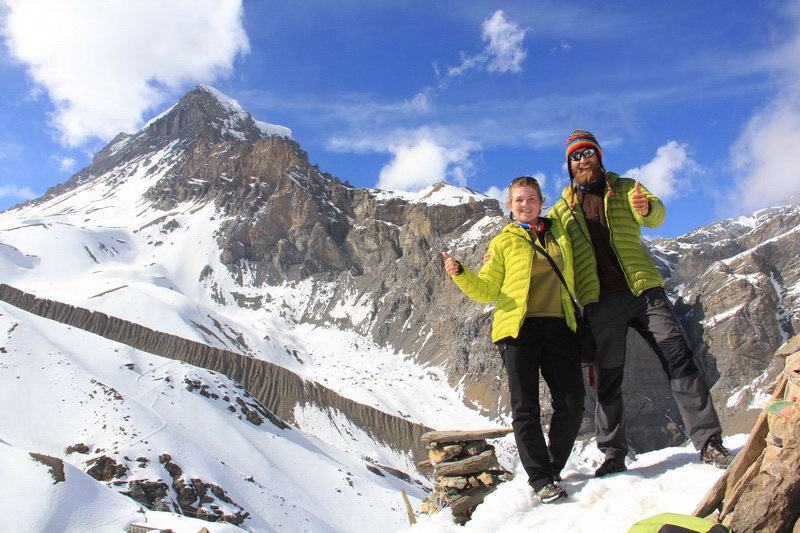
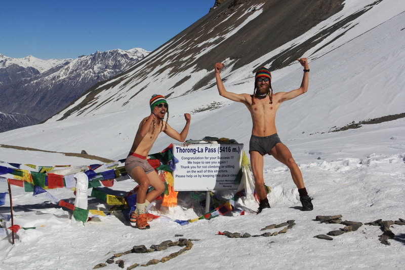
The ascent was quite easy and we reached the pass at 8:20, i.e. the ascent took 2.5 hours. There were already people on the pass and new ones were constantly coming up, replacing the ones who had left. There was no wind on the pass, the sun was very warm and some decided to take pictures in their underpants.
We started the descent at 9:05 a.m. and very quickly the initially gentle slope turned into a steep snow-mud descent. On the descent, there was an opportunity to ride a priest on the snowy slopes smoothly turning into mud.
The descent was harder than the ascent, and it was only at 12:05 that we were in the Champber Bu. Champber Boo is a series of cafe-hotels where it makes sense to stay either for lunch or if you are completely tired. Going down from Champber Bu to Muktinath, you should keep to the left side of the valley, although the car road will try to take you to the right. On the left side of the valley there is a path that leads to a suspension bridge, with which you will cross to the left bank. If you do not do this, then you will be able to wander around the neighborhood.
The descent to Muktinath takes about 1 hour, but since we did not stick to the left slope at the beginning, the descent took us 1:15.
There is a large Buddhist temple at the entrance to Muktinath, which is better bypassed by the lower road. At the beginning of Muktinath, there are not the cheapest hotels. And it is necessary to evaluate the hotel not by the price of the room, but by the menu. Prices may vary by 100-150 rupees.
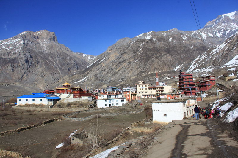
After passing expensive hotels, we got to cheaper ones, but some did not have a hot shower, others had wi-fi. And finally we found a hotel with a hot shower, internet and the cheapest menu we have seen in Muktinath. It was the Caravan hotel, we paid 50 rupees for a room, although in some places they offer it for free, but the savings even on the 1st dish exceeded the cost of the room.
There is a check post in Muktinath and you need to check in on it. There is a bus station where jeeps leave, where and how much we did not find out, but according to our friends, the fare to Jomsom is 800 rupees.
In total, the ascent from the High Camp and the descent to Muktinath took 7:20, with all the entertainment and stops.
Muktinath - Jomsom - Marfa
The morning was sunny and we went to Jomsom as planned. Yesterday we looked at the map and turned to the route through the village of Lupra.
The route passes through a jeep parking lot, followed by a helipad, and then it gets worse. There are a lot of trails, no markings, snow in places. In general, by hook or by crook, we came to a double hill through which the trail is visible. There is even a sign with a Loupra sign at the bottom. However, in addition to the trail, there are still tracks going up over the ridge, but we decided to follow the sign.
The ascent is small and uncomplicated, there were snow patches in a couple of places, but someone has already trickled the way through them.
At the top of the hill there is a rather large clearing half in the snow and the trail of course gets lost in it. There are footprints up the hill, there are many footprints below. But after checking the map, we realized that this was not the right pass. In general, we decided to go down and walk along the road.
Having already dropped 150-200 meters, we noticed that from the pass where we were, the trail traverses to the left and leads to the desired pass. But the trail is covered in snow, there are no tracks and it is not readable at close range. And we continued downhill.
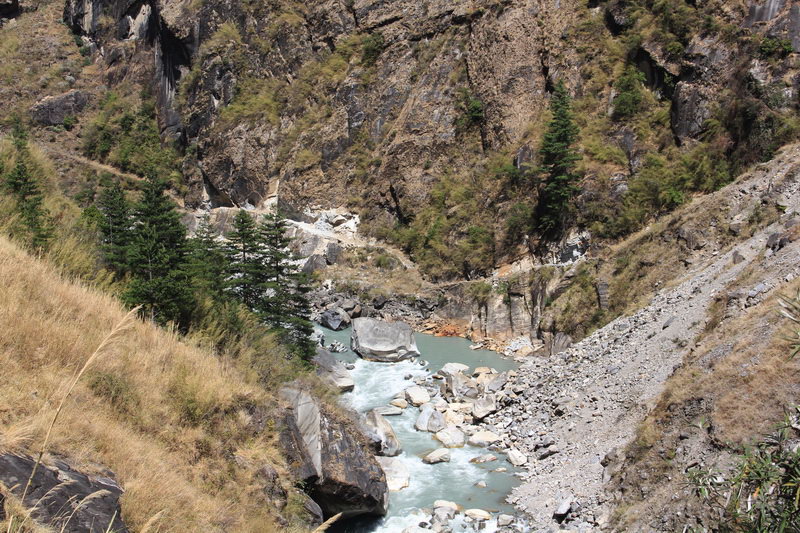
We went down near the village of Khingar. And then we went down the road. Soon the main road goes to Kagbeni, and the second one, which cuts to the left, turns into the gorge of the Kali Gandaki River. We went to make cuts. The road eventually turned into a trail. And at the turn into the gorge, the trail passes among the rocks, from where there are simply excellent views of Kagbeni, and the rocks are also very picturesque.
Further on, the trail gradually drops in height and connects to the main road. Along the way, there are small villages like Ekle-Baty, which have a couple of cafes and hotels.
The road goes along the river, sometimes climbing higher up the slope, but there is a hiking trail right along the riverbed, and only in a place where the river comes very close to the slope, the trail rises to the slope for a couple of meters.
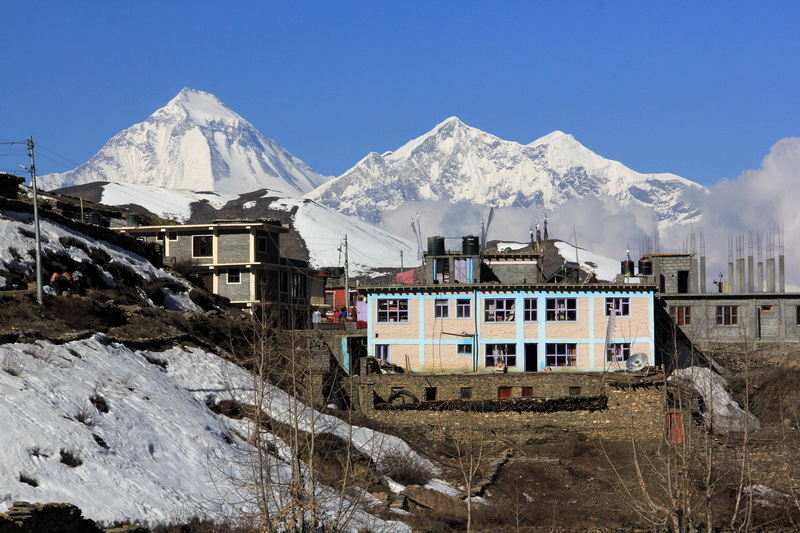
About 1.5 hours after the Eclectic Party, we arrived at Jomsom. The village is very large, there is a monastery at the entrance and a parking lot for jeeps with buses. We went to a couple of gests, but the owners were charging crazy prices for rooms (at least 400 rupees ($4)) and the prices on the menu were comparable to the prices in the High Camp.
So we decided to go to Marfa to eat apple pies and drink apple cider.
We were just about to cross to the right bank of the river and take the auto road to Marfa, when we saw a marker and a pointer to Marfa, which pointed in the opposite direction from the bridge. The morning walk did not teach us anything, the track is certainly more interesting - we thought and followed the markers.
The street moved further away from the river, while gaining height, markers were surprisingly regular. Here is the village of Thini, a couple of local guys were very surprised that we were going to Marfa, they say 8km there. But we read that it's a 1-hour drive there, though on the way...
In general, let's move on. There is a track map in the village where Marfa is not even close, but there are a couple of other villages. It's getting close to evening. Having looked at what Samle and Dhumbra said, we go further along the way. But a map constantly pops up in my head, where the nearest bridge to the other side of the river, just where Marfa is, is 2-3 km beyond Marfa.
The road is constantly gradually going higher and higher, and now there is a shield with a map at the entrance to the village of Dhumbre. And to our joy, some kind of agricultural road is indicated on this shield, next to which there is a bridge on the other side of the river to the village of Syang and from it the road to Marfa.
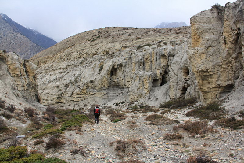
It began to rain. Spitting on the track, we decided to find a bridge and continue along the highway. We go down the steep goat path through the gorge, surrounded by picturesque sandy cliffs with caves and grottoes. Behind all this beauty, there are semi-swampy fields with no clear reason. We go around, along the way there are stones with a red arrow that points to an unknown place. Further along our path, we met strange man-made ponds, or fields with up to half a meter of water. We walk along the embankment between them and get into the orchard, but it's early spring and there are no fruits. Some local waved his hand - you don't come here, you go there. But we could not understand from his gesture where we should go, but we headed for the gate from the garden, which could be seen on the left. There was a field outside the gate, part of which the local kids used as a football field. And even further away, there was a suspension bridge over the river.
Glad that the bridge still exists, we headed in his direction. There was also some kind of road, but it was difficult to get to it, because all the approaches were swampy. Somehow we got onto the road and reached the bridge. There was another older one behind him. But we decided not to take any chances and move here.
There is some kind of woodworking workshop behind the bridge, at least there are a lot of boards there. The road goes to the left and eventually merges with the main road.
Well, we are 1.5 km from Jomsom, and we spent 45 minutes and effort. It's already 17 o'clock, and we still have to stomp and stomp. The rain is trying to fall and it's working out, but so far it's not strong, and we have daylight.
And now the road crosses a bridge over a side tributary and we see Marfa. The journey from Jomsom to Marfa, according to our version of the route, took about 1:40 hours.
Before Marfa, the road branches off, the automobile goes down without entering the village, and the second goes to the right and becomes pedestrian passes through the village. We went to a couple of gests, but the prices on the menu were not bad, but we decided to look for more, especially since the rooms cost from 150 rupees. In total, we found the Sunrise Hotel with shared hot showers, wi-fi and good prices on the menu. The cost of a room in this hotel is 60 rupees, but they gave us a discount and we paid 40 rupees ($0.4).
At this hotel we tasted delicious apple cider (100 rupees glass ($1)).
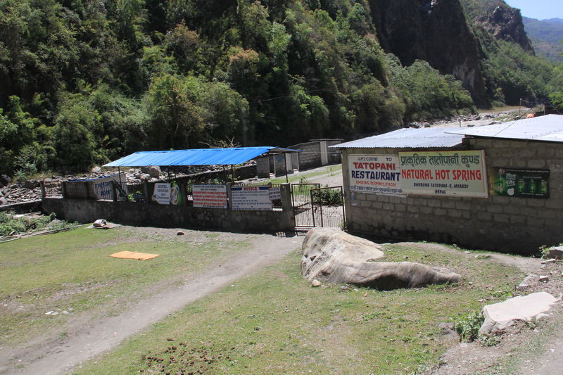
Marfa - Tatopani
After sleeping it off, we decided to continue our journey to Tatopani. We went to the bus stop for tickets, which is located at the far end of the village, where the pedestrian and highway connect. There are buses at 8 and at 12, but only to Ghasa. The ticket costs 700 rupees. We thought something expensive and went home to look at the map. We have already decided to walk, although it is far enough, but it started to rain and we had to change our plans.
After looking at the reports on the Internet, it turned out that buses have always cost about the same. In general, the Marfa Ghaza bus is 2 hours 40 minutes, 700 rupees.
In Ghaza, the bus arrives at a kind of bus station, there is a ticket office, but the buses leave on filling. A ticket to Tatopani costs 360 rupees. A bus just left in front of us, but people were found for another one within 15 minutes, so you probably won't have to wait long.
The bus to Tatopani takes about 2 hours. In Tatopani, buses arrive at the clearing, and it is not immediately clear what the village is. But if you look to the right and up, you see houses and hotel signs. And if you walk 200 meters along the road, you will come across hot springs - this is a fenced area with a couple of pools, from which steam is coming down. The entrance costs 100 rupees ($1), there are changing rooms, a toilet, a cafe on the territory, by the way, with very normal prices. The springs are open from early morning until late evening.
At the end of the clearing, where the bus arrived, there is a stone staircase that leads up to the village. The path upstairs passes through one of the gests, by the way, with the cheapest prices for a room in Tatopani - 80 rupees/double /night, but we did not look at the conditions.
In all gests, the menu and prices are different, so we chose the menu and the prices in it, and then haggled over the room. Importantly, some gests have wi-fi, but when we had electricity from batteries and wi-fi did not work anywhere.
We stayed at Kali Gandaki Lodge, which is visible from the bus arrival point. In it, we liked the menu prices plus room prices the most. However, at first the room cost 200 rupees, but after a light haggling it became 100 rupees. However, this lodge does not have a hot shower, like many others in Tatopani. In some lodges, however, it is available, but for an additional fee. So it's easier and better for 100 rupees to go and soak in the hot pool, there is also a hot shower where you can wash, though in plain sight.
Tatopani - Pokhara
We spent the morning in the hot springs, and then, disappointed by the weather forecast, decided to go to Pokhara, without an additional walk through the mountains. By the time we got ready and went to the bus stop, it was already half past eleven. There are no bus ticket offices in Tatopani and there are no direct buses to Pokhara, you have to go through Beni.
We were told that almost all passing buses go to Beni and we waited. After 15 minutes, a man came up and offered to drive to Beni for 500 rupees ($5) per person, he said that there were already enough people for the car, but we waited for mo-mo, who cooked for us in a nearby cafe and asked for 10 minutes. And after 5 minutes, as ordered, they serve mo-mo, before we could sit down in the cafe, the bus arrived and of course it goes to Beni. The cost is 300 rupees ($3) per person.
We packed mo-mo with us and took the bus. But the man with the car remained standing, with no other passengers being observed.
The bus went to Beni for 1 hour and 50 minutes and came to a large dusty square where many buses, minivans, jeeps and taxis had accumulated. Everyone is vying to go to Pokhara. The minivan was offered for 350 rupees ($3.5) per person. But we went a little further to the ticket office of the bus and took a ticket for 210 rupees ($ 2.1).
We were lucky, the bus left in 10 minutes. On the way, the bus filled up and emptied several times, and also stopped in every village. The road from Beni to Pokhara is better than it was before Beni. In places, even asphalt is found.
4.5 hours later we were in Pokhara. Tourists are dropped off at the point closest to the Lakeside, from there you can walk to the embankment in 15-20 minutes, visiting a bunch of hotels on the way. You can also stay in and go to the bus station, and from there take a city bus to Lake Side for 20 rupees.
We chose the first option and after 10 minutes we were choosing a hotel. On average, for 700-800 rupees ($ 7-8), you can get a separate excellent room with a hot shower and wi-fi. You don't have to eat at the hotel anymore, so the rooms are more expensive. And yet, at the expense of the cost of the room, you can and should bargain.
We stayed at the New Tourist Guest House for 550 rupees for a room with amenities, and the next day we moved into a room with shared facilities for 400 rupees. In many hotels and guest houses, they generally "forget" to mention the availability of rooms with shared facilities.
In Pokhara, in culinary terms, you can give yourself free rein, in the sense that there is more choice and prices are lower. Although how to say it below... In some cafes right on the waterfront, prices are much higher than in the High Camp. But if you go a little deeper, then the prices are already good. And we found generally excellent ones - for a dish (rice / noodles / mo-mo / soup) with meat filling only 70-100 rupees. There are also many shops with fruits and vegetables, by the way, we were most attracted by fresh juicy carrots.
At this point, the track can be considered finished, it remains only to return to Kathmandu. And here, too, there is a choice: flight, tourist and local buses. A flight is if there is no time at all and there is money. Tourist bus - from 600 to 2300 rupees (6 - 23 $). For 600 rupees, the bus is simpler and without food, and for 2300 a bus with air conditioning and two meals. It starts at 7:30 from the Tourist Bus Station (20 minutes walk from Lakeside towards the airport). Arrives in Kathmandu in the Thamel area around 14:30. The local bus will stop a million times, a local one with clunks will hang over you, Indian music will play in the cabin, departure time depends on which company to go, the cost is 410 - 460 rupees (4.1-4.6$). The bus station is on the north side of the airport, walking from the lakeside for about 40 minutes.
Well, that's all, and you can read about what to do in Pokhara here.
At this point, we considered our track around Annapurna to be finished. A few days later, we were scheduled to start a new track - to the Everest base camp.
In the meantime, we have a few days of rest, we decided to spend them in Pokhara. You can read about what to see in Pokhara here. And there are also a lot of cool photos of Phewa Lake, the stupa of the World and Machapuchare Mountain.
The sights of Pokhara, the tropics among the snowy peaks
Pokhara is a quiet and pleasant Nepalese town located on the shores of Lake Fewa in a huge green valley surrounded by mountains. Pokhara is the second largest city in Nepal, the city has a populati...