The route of climbing the classics through the top is separate
Driving to Lenin Peak along the classic route starts from the Base Camp, located at an altitude of 3,500 meters.
More precisely, several camps of various travel agencies are scattered on the ancient moraine of the glacier, but the whole area is usually called by one name - base camp, also known as bazlag or BL. There is still scant vegetation in the form of grass and there is still enough air to breathe in a normal rhythm.
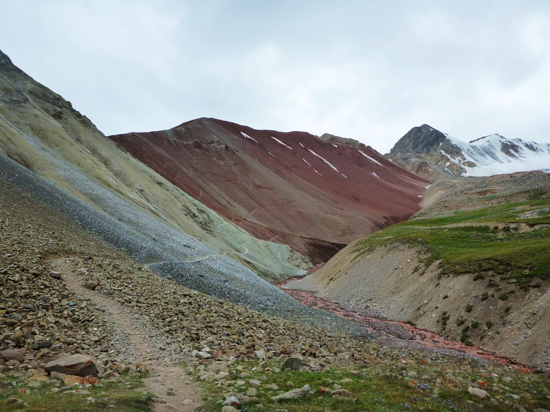
Trails start from the camps of all travel agencies, which as a result merge into one road. This road goes up the valley and goes into the gorge from which the river flows in the right part of the valley (if you look up).
Memorial plaques about the climbers who died at Lenin Peak are located on the rocks at the entrance to the gorge.
Along the gorge, the trail runs parallel to the river to the Travelers' pass (4,200 m), through which you need to cross into the neighboring valley. Then the trail continues along the glacier to Camp 1 (4,200 - 4,400 m). Then the path goes through the cracked glacier and the snow plateau "skovorodka" to Camp 2 (5,300 m). The third camp is an assault camp, it is located at an altitude of 6100 m, almost at the top of Razdelnaya (6200m). Further ascent takes place along the ridge, through the plateau at 6400 m, the snow- ice takeoff "knife" and the pre-summit snowfields to the peak designated by the tour.
Lenin Peak Base Camp
Until 2007, the base camp of Lenin Peak was located in the Onion Meadow, so named because it was densely overgrown with wild onions. However, with the increase in the number of climbers, almost all vegetation was trampled. Therefore, since 2007, at the insistence of environmentalists, the base camp was moved a little lower to the Edelweiss meadow (Achik-Tash). The height is 3500m.
Now there are several camps of various travel agencies scattered in this place, the most recent camps have already begun to get closer to the Onion Meadow again.

Base Camp (3,500 m) - Camp 1 (4,300 m)
The dirt road from the base camp goes first to the Onion Meadow. Then the road ends and the trail begins, it enters the gorge through which the river flows.
Next, a well-packed trail runs parallel to the river to the Travelers' pass, where it turns onto the pass and rises up in a serpentine, the height is 4128 m. Time to get up from the camp: 1.5 - 2.5 hours.
The most annoying thing is that after climbing the pass, almost all the gained height must be dropped - from the pass descent to the left moraine of the Lenin glacier.
The trail traverses a steep scree slope. Stones may fall in some places.
When approaching Camp 1, the trail crosses the river. The water level in the river strongly depends on the weather and time of day. The best time to cross the river is before 12 o'clock in the afternoon, after that you will not be able to cross the stones without getting your feet wet. The current is quite strong, and the water is all dirty from clay, so there is not even a special desire to wade across. But the local enterprising Kyrgyz have found a way out - during the day, drovers with horses are constantly on duty at the ford, who for $ 5 will gladly transport you to the other shore. But it is still better to calculate your route so that the crossing is before 12 o'clock in the afternoon.
After the river, the trail ascends to the moraine of the Lenin Glacier and then winds between ravines and hills along the moraine.
There are several camps of different travel agencies scattered on the moraine and a bunch of trails between them, so it's not easy to find the right path, but as a result they will all lead somewhere.
Travel time from bazlag is 4-6 hours.
Camp 1 (4,300 m) - Camp 2 (5,300 m)
Trails from all camps cross the moraine and separate sections of ice and go to the camps on the far left (Central Asia Travel and Fortuna tour). After that, the trail goes out onto the flat part of the Lenin Glacier and goes to the beginning of a steep slope in the direction of the summit.
The ascent goes along a steep snow slope through a large number of narrow cracks. But the condition strongly depends on the amount of snow. Steep sections alternate with more gentle ones.
Next, the route goes along a steep snow-ice slope between two icefalls, climbing almost straight up. One of the sections with a length of about 100 meters reaches a steepness of 35-40 °.
Railings are stretched through large cracks and hangers are installed along the path. Perhaps the hangers and railings appear only before the Lenin Race, the annual high-speed race to the top of Lenin Peak.
After takeoff, the slope becomes less steep, but the number of cracks and their size increase. In the middle of the season, they are all open and not dangerous, but at the beginning, when no one has walked here yet, you need to be extremely careful.
After overcoming the steep part of the ascent, the trail turns to the right and gradually creeping out, comes out on the snow-ice plateau "skovorodka". In sunny weather, the snowy slopes that surround the plateau reflect the sun's rays and therefore it can be very hot in the “frying pan”.

The frying pan begins at an altitude of 5100 and the path through it can be avalanche-prone, and an icefall with huge cracks begins to the left of the trail, where all the avalanches go. This is another reason to get through this section as early as possible.
Camp 2 is located on a scree slope under a rocky ridge on the left side of the trail, but with a large number of tents it grows into the beginning of the glacier, and the tents stand directly in the snow above the cracks.
A little to the left of the upper part of the camp, in a hollow there is a small stream from which you can draw water, usually a path is trampled to it.
And stones sometimes fall from the rocky ridge above the camp, so it's better to put a tent in the upper part of the camp, away from the rocks.
From the “frying pan” there is a small ascent to Camp 2. The travel time from Camp 1 is about 4-6 hours. Movement in cats and bundles.
For acclimatization, if you still have strength left, you can walk to the bridge above Camp 2 with a height of 5600 m. The time of ascent from Camp 2 to the bridge 1 is 1.5 hours.
Camp 2 (5,300 m) - Camp 3 (6,100 m)
Right from the top of the camp begins a steep trail climbing the ridge to a height of 5,600 m. The trail initially follows the glacier and crosses several small cracks. After the glacier, the ascent continues along the snowfield until it reaches a wide ridge. The lifting time is 1-1.5 hours.
There is a possibility of setting up an intermediate camp on the ridge.
Then the trail goes along the ridge in the direction of Razdelnaya peak. Part of the route along the ridge goes with a smooth climb.

After a gentle section of the ridge, the most difficult part of the climb begins. A steep slope without any flattening. The height difference is about 300 - 350 meters. Very often there is deep snow on the rise, and during the night the wind covers all tracks, so you have to trail. The path goes straight “head”on".
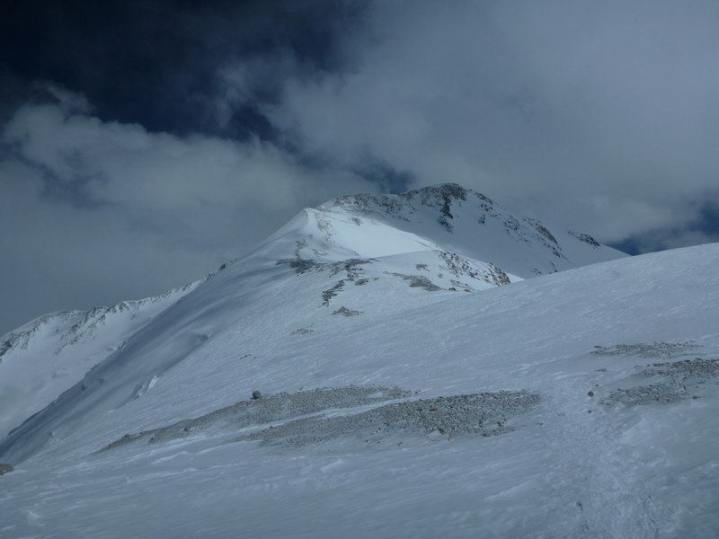
Camp 3 is located on the pre-summit plateau of Razdelnaya, with an altitude of 6100 meters.
The tents are located on a flat part of the plateau, in snow pits or surrounded by snow walls, as very strong winds are possible here, especially at night.

If you have the desire and strength, then you can go to the very top of Razdelnaya. Climbing a gentle snow slope, the trail starts right behind the camp. The height of the peak is 6200 meters apart.
To the left of the camp begins the descent to the saddle between Razdelnaya and Lenin Peak.
The ascent time from Camp 2 to Camp 3 takes about 4-6 hours.
Camp 3 (6100 m) - the top of Lenin Peak (7134 m) - Camp 3 (6100 m)
The route of climbing Lenin Peak begins with the fact that from Camp 3, almost at the top of Razdelnaya, you need to go down to the saddle between Razdelnaya and the Lenin Peak massif. The saddle is about 100 meters below the camp.
You need to go climbing early in the morning, the usual exit time is 3 - 5 a.m.

From the saddle (6000 m), the ascent route goes up along a rocky ridge, then going out into the snow and returning to the stones.
After the first, relatively steep takeoff, the slope flattens out a little and the trail goes along an almost flat plateau for a while.
After several more sections of a simple slope of varying steepness, the route approaches the most difficult section of the climbing route.
A narrow snow-ice ridge about 200 meters long with a steep takeoff is a “knife". The wide and gentle snow ridge gradually narrows and becomes steeper, the last section has a steepness of about 45 degrees and a length of about 50 meters in height.
After the knife, the trail passes through simple rocks and through a “stone glade” - a flat area with fragments of rocks where you can make a halt.
After the stone glade, the trail opens onto snowfields that need to be crossed.
The trail goes for quite a long time almost without climbing. But there is often a lot of snow and you need to trail, which slows down the pace and takes a lot of energy. This place is considered to be the beginning of the pre-summit plateau. The height is 6900 meters.
Then the rocky hills begin forming a pre-summit dome. The path goes along the left side of the dome.
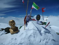
Sections of rock climbing alternate with flat sections. After several such pieces, the route goes to another rocky hillock, which is the top.
It differs from the neighboring piles of stones only in the presence of flags, all sorts of signs and half of Lenin's carcass.

The time of ascent from the top of Razdelnaya to Lenin peak is 7-9 hours.
The descent from the summit to Camp 3 follows the path of ascent. The average descent time is 3-5 hours.
If you have not reached the top before two o'clock in the afternoon, it is better to return to Camp 3. After two o'clock, as a rule, the weather begins to deteriorate, and there is a risk of getting into severe bad weather, fog and hurricane wind. The scariest thing in this whole situation is that it is not difficult to get lost on the pre-summit dome among the same hills, and the wind covers up the tracks, so you need to have a GPS with an ascent track with you.
Climbing Lenin Peak or how I spent the summer
The story of climbing Lenin Peak began long before this summer and even this spring.
In general, it was like this…
After climbing Kazbek and Elbrus, it was possible to think about s...


")